blog-and-news

What is an Extratropical Cyclone?

Es un sistema atmosférico cuya fuente primaria de energía es el gradiente horizontal de la temperatura. Los ciclones extratropicales son sistemas de baja presión asociados a frentes fríos, cálidos o ocluídos. Los ciclones tropicales, a diferencia de los extratropicales, no manifiestan un gradiente horizontal de temperaturas tan sustancial en todo el diámetro de la tormenta, a nivel de la superficie, y sus vientos son generados por la liberación de energía durante la formación de las nubes y la lluvia; estos se componen por dos o más masas de aire (cálido o frío), por lo tanto se asocia a uno o más frentes.

The upper diagrams show horizontal maps of surface temperature, pressure, and wind fields associated with a tropical cyclone (left) and an extratropical cyclone (right) . Colors indicate temperature (blue 15 ° C = 59 ° F, green blue 20 ° C = 68 ° F, green 25 ° C = 77 ° F). Dashed lines indicate surface wind speeds: 34 kt = 39 mph = 63 kph, 64 kt = 74 mph = 117 kph, and 96 kt = 110 mph = 174 kph. Continuous lines are the isobars.
The diagrams below show maps of vertical pressure surfaces, temperature anomalies, and surface circulation and tropopause.

The strongest winds in a tropical cyclone occur near the earth's surface, while in an extratropical cyclone the strongest winds occur near the tropopause (at a height of 12 km (8 miles). These differences arise as a consequence of that the tropical cyclone has a "warm core" in the troposphere (below the tropopause), while the extratropical cyclone has a cold core in the troposphere and warm in the stratosphere (above the tropopause). The expression "warm core" it means that the center of the cyclone is warmer than the environment at the periphery of the storm, on the same isobaric surface (speaking of isobaric surfaces is like speaking of heights from the ground). Contribution Stan Goldenberg source: NOA

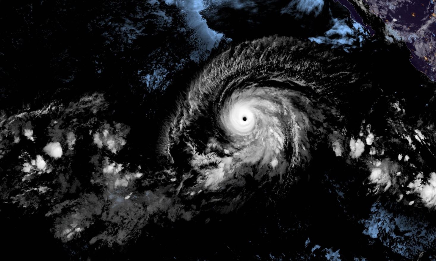
Barbara escalates to powerful Category 4 hurricane

Climate change in action?


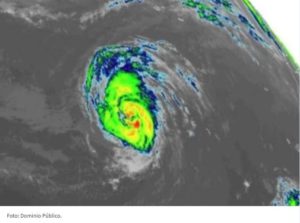
Tropical Storm Barbara in the Pacific Ocean quickly became a Category 4 hurricane and developed, achieving a record time of less than 24 hours. This fact leaves a strong message that the rapid development of these systems must be monitored even more today as there is increasing speed and intensity.

It is a great hurricane , fortunately it will not impact national terrain, however, there is vigilance for Hawaii .

source: catastrofesmundiales.com

Reefs and QRoo Beach have hurricane insurance

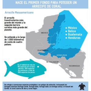
La Conanp detalló que el seguro, ofrecido por Afirme Seguros, permitirá tener fondos para reparar los daños al arrecife.

The National Commission for Protected Natural Areas ( Conanp ) reported that the reefs and beaches of Quintana Roo already have a hurricane insurance policy and detailed that this policy is the first of its kind.

He added that this action is a strategic and innovative step as it recognizes the importance of the benefits that nature provides to people and the economy, the risk to which they are exposed and the need to conserve them.

The reefs maintain the tourism industry in Quintana Roo, providing valuable coastal protection against storms, reducing erosion of beaches , producing white sand and attracting more than one million divers a year.

While reefs are exposed to various threats, hurricanes are an extreme risk, as category 5 storms, for example, can wipe out 60 percent of live coral cover and cause serious structural damage in just a few hours.

Conanp explained that the insurance, offered by Affirm Insurance, will allow funds to repair damage to the reef after a hurricane, which will reduce losses to the economy and its ability to protect the coastal zone.

As part of this project, the The Nature Conservancy, the Conanp and the Regional Center for Aquaculture and Fisheries Research (CRIAP) will provide training to the so-called Reef Guardians, who they have the ability to rehabilitate reefs in Isla Mujeres, bringing the total number of Reef Guardians to 60 in this region.

source: MVSNoticias

IS YOUR HOME OR BUSINESS REALLY PROTECTED AGAINST THE FULMINATING FORCE OF A HURRICANE?

Is your home or business really protected from the sudden force of a hurricane?


Many people when asking this really believe that if they are protected and ready to react to the withering force of a hurricane, which we leave you…

Reasons why obtaining cyclonic protection is convenient for you and your family.

Living in a coastal region, it is important not to go unnoticed and to consider how dangerous the impact of a cyclone could be. When taking safety precautions it is easy to underestimate the amount of damage a hurricane can cause, however it is substantial that you take the time to prepare your family and property in the event of a storm.

The safety of yours is paramount, for this reason, we give you some reasons and / or recommendations why becoming a creditor of anticyclonic protection is a smart decision.


1.- PROTECT YOUR HOME DURING THE PASSAGE OF A HURRICANE

Hurricanes have been increasing in strength over the years due to global warming, which puts very great pressure on the windows that are exposed to it, and breaks them easily, leaving your property vulnerable to rains and debris that can cause significant damage to your home.
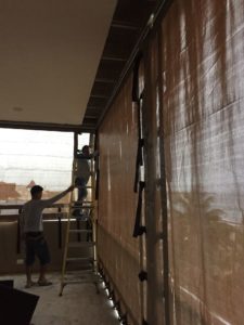
An anti-hurricane security system, keeps any possible threat off your property, keeping you and your family totally healthy and safe.


2.- EASY TO INSTALL

Stormcatcher en acción

There are two types of anticyclonic systems ( temporary and permanent ) which are chosen depending on the preference of the client. Many times to take care of your facade or visually it looks great, since any modality protects.

In the case of temporary (polypropylene anticyclonic mesh, panels) they can be mounted and dismounted when the client needs it; On the other hand, the permanent such as aluminum blinds, folding aluminum, will be fixed to your window giving security whenever you require it.

3.- LONG-TERM BENEFITS

Compared to other forms of protection against hurricanes, such as impact windows or reinforced doors, the security benefit is acquired in the long term, since taking into account the low cost it has, it also resists much longer than other types of solutions .

The range of protections is very varied, as well as there are different factors which can make one type of protection more optimal than others, such as window measurements, location or community regulations.

Investing in a cyclone protection system is a decision that can provide future benefits, in short it is a smart decision.

Andrea forms, the first probable Caribbean Tropical Storm


For the North Atlantic ... Caribbean Sea and Gulf of Mexico: 1.

Showers and thunderstorms associated with a wide area of ​​low. Pressure several hundred miles southwest of Bermuda is showing signs of organization. Although recent satellite wind data suggests that the system currently lacks a circulation center, the environmental conditions are expected to be conducive.

For the formation of a short-lived tropical or subtropical cyclone. Later today or tonight. Conditions are expected to become unfavorable for further development by the end of Tuesday, and the disturbance is expected to merge with a cold front on Wednesday. A reconnaissance aircraft from the Air Reserve is currently en route To investigate the riot. Interests in Bermuda must Monitor the progress of this system. The next Tropical Special Weather Outlook will be issued today at 8 PM EDT.

* Possibility of training through 48 hours ... high ... 70 percent.

* Possibility of training through 5 days ... high ... 70 percent.


Fuente: NOA

HURRICANE SEASON BEGINS 2019 How many hurricanes are expected?

The hurricane season began today in the Pacific and in the Atlantic it will begin in June, both will end in late November of this 2019. The names of the hurricanes are recycled every six years.

For this hurricane season in the Atlantic this is the forecast.

Asimismo, se pronosticó Centro Nacional de Huracanes (NHC, por sus siglas en inglés) que en el Océano Pacífico habrán 24 huracanes, mientras que para el Atlántico prevé 21.


source: Sipse.com

12-14 storms forecast for Hurricane Season 2019

The density map of the above tropical trajectory was created by analyzing analog years, which are past years that have weather patterns similar to current and projected weather patterns. Analogous years are often used to predict future trends and impacts during a hurricane season. They can be based solely on the El Niño phenomenon or on a combination of weather patterns and teleconnections, which are weather patterns that occur in another part of the world and that can significantly influence current or future weather in a particular area of ​​concern.

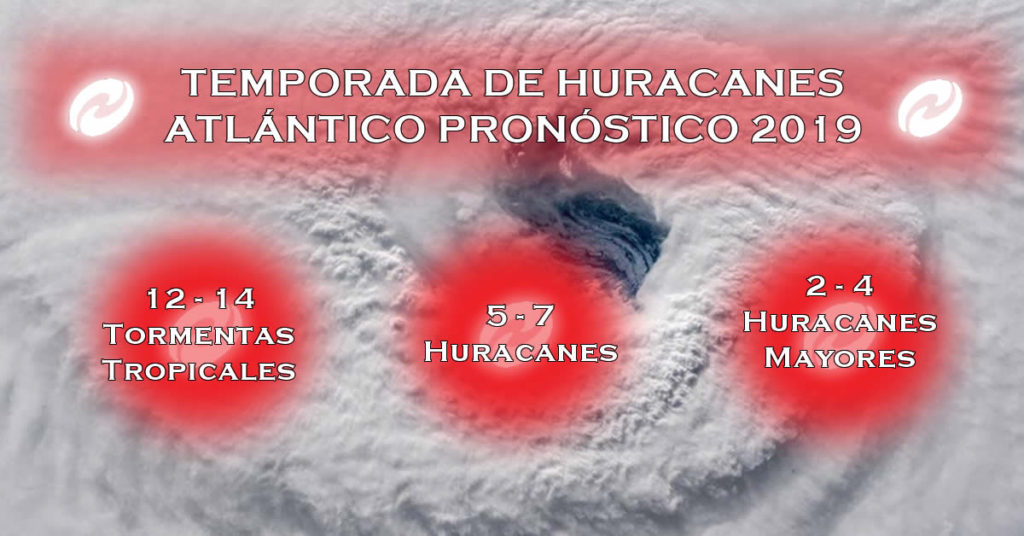
After experiencing an active Atlantic hurricane season last year, AccuWeather's group of experts predicts that 2019 will be a slightly higher than normal season with a total of 12 to 14 storms.

Of those storms, five to seven are forecast to become hurricanes, and two to four are expected to be category three or more hurricanes.

"This year, we believe there will be fewer tropical storms and fewer hurricanes, but it only takes one to cause significant damage," said AccuWeather hurricane expert Dan Kottlowski.

After Hurricanes Michael and Florence hit the US USA Last year, the expert points out that history could repeat itself with the impact of between two to four atmospheric phenomena in the region.

To help predict the upcoming season, forecasters have drawn comparisons to previous years with comparable weather conditions, also known as analog years.

In this case, due to its similarity, the year analogous to the current pattern is 1969.

During that season, Hurricane Camille impacted the Mobile, Alabama region, making it one of only three Category 5 hurricanes to have impacted the United States.

But that doesn't mean we experience something similar this year, Kottlowski said.

At the beginning of the season, however, AccuWeather meteorologists will be monitoring development potential on the southeast coast, the Gulf of Mexico and the Caribbean.

"Those are the areas that we will monitor very closely, not only from June, but from April to May, since the Atlantic temperatures are high," said the expert.

THE HURRICANE SEASON IN THE ATLANTIC OFFICIALLY STARTS JUNE 1

If this [El Niño] pattern continues or strengthens, then the number of tropical storms and hurricanes will be near or below normal, "said Kottlowski. "If El Niño weakens and becomes neutral, the number of tropical storms and hurricanes could be higher than normal," he added.

source: AccuWeather

WHAT IS A "ZOMBIE HURRICANE"?

Accu Weather first alerted to this phenomenon.

Cancun.- When Hurricane Leslie threatened the Canary Islands last September, meteorology expert Dan Kottlowski found that the data and forecasts described a zombie hurricane or dying.

The company AccuWeather, specializing in climate, immediately used the term to define a cyclone with no definite or predictable course .

Thus, ' zombie hurricane ' is understood to mean a phenomenon that, despite the clues obtained by satellite and other instruments, scientists do not reach a general consensus on the place of impact, its level of force and, above all, its life time.

Leslie, the zombie hurricane, hit Portugal on October 14, 2018

According to the Spanish ABC, Kottlowski considered Leslie as a z zombie hurricane ’because in 2018 she did not know when she would die.

And it is that Leslie meandered the Atlantic for more than 10 days surviving hot and humid waters and weather systems that could not stop him. The phenomenon finally impacted the coasts of Portugal. That would be the first time that a cyclone of that category and force had touched that region since 1842.

source: Sipse.com

THE WORST CYCLONE IN INDIA LEAVES AT LEAST 3 DEAD (video)

Cyclone Fani is considered the most powerful in the past 53 years.

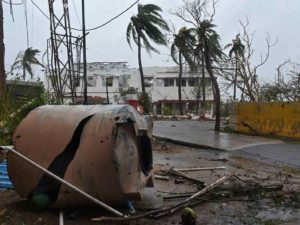
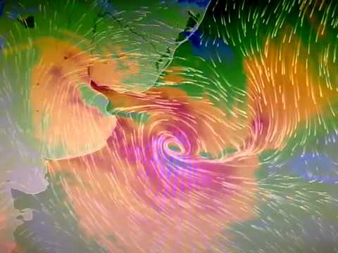
INDIA.- This cyclone Fani, considered the most powerful cyclone that has rocked India in the last 43 years , reached the east coast near the city Puri (Odisha state), leaving at least three dead, they report local media.

According to RT, the phenomenon has uprooted hundreds of trees in its path, causing serious damage to energy infrastructure and homes. According to the media The Hindu, storm winds already reach 175 kilometers per hour.

Watch the AWESOME video! Click -> Here

At least 10,000 villages and 52 cities in nine districts will be affected by the meteorological phenomenon , according to data from the Odisha Government, which has advised the population to stay inside their homes on the day of this Friday.

Airports located on the cyclone route are being closed, while flight operations from Odisha's capital Bhubaneswar airport have been suspended since midnight on Thursday.


source: SIPSE.COM

MEXICAN AUTHORITIES DECLARE READY TO FACE HURRICANE SEASON 2019

This Thursday a simulation was carried out at Cenapred on the hypothesis of a category 5 hurricane off the coast of Guerrero; the rainy and cyclone season begins on May 15.


As a successful, formative and confidence-building exercise, the head of the Civil Protection National Coordination, David León Romero, described the drill carried out this Thursday at the National Center for Disaster Prevention ( Cenapred ), on the hypothesis of a Category 5 hurricane on the coasts of Guerrero.

In this way, the National Emergency Committee declared itself ready to face the rainy and hurricane season that begins on May 15 and concludes on November 30 in the country.

In the simulation of the supposed hurricane "Viridiana", which lasted 3 hours and 40 minutes, 52 specialists from 38 agencies participated in the processing of information, analysis, decision-making and creation of solutions

During the civil protection exercise, two damage assessment and needs analysis reports were issued, two links with the National Center for Communication and Emergencies, and 36 messages were prepared for the coordination of actions.

" During this drill, we particularly had some scenarios of river overflow, collapse of some structures, floods, evacuations in buildings, particularly health, road closures due to bridge collapses, that is, different scenarios that my colleagues and I had to be solving throughout those minutes to be able to provide answers to this table and with it to be able to measure the response capacity of these institutions ”, explained David León Romero.

Autoridades se declaran listas para afrontar temporada de huracanes

The head of the National Coordination of Civil Protection highlighted that some areas of opportunity they found to improve care are the use of new technologies for handling and processing information in real time with greater agility and strengthening the communication protocol with the media to avoid rumors or false news on social networks.

He recalled that hydrometeorological phenomena consume 80% of the budget allocated to emergency care, since just last year 214 events were registered, of which 41 were tropical cyclones and of them, 6 touched the country.

source: Excelsior

en_USEN