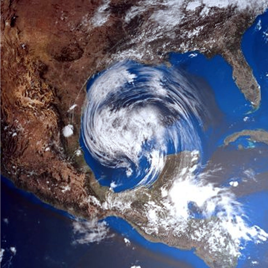
2019, A YEAR WITH A LARGE NUMBER OF EXTREME METEOROLOGICAL PHENOMENA

The rainy season and tropical cyclones will begin on May 15, according to experts.


Mexico.- This year in the Pacific seas a weak El Niño phenomenon will be registered, which will generate a large number of extreme weather events and we must be ready to face them, warned Blanca Jiménez, director of the National Water Commission (Conagua).

During her participation in the inter-institutional meeting held at the National Center for Disaster Prevention (Cenapred), the environmental engineer stressed that we must be prepared for the imminent rainy season and tropical cyclones, which will begin on May 15 and end on November 30.

In order to establish the most appropriate lines of action to be applied before, during and after of a possible emergency, the proposal is to work, in a coordinated manner and putting aside any partisan affiliation, between the three levels of government , as well as establishing closer and closer communication with the population, added David León Romero, national coordinator of Civil Protection.

According to UNAM Global, to consolidate this strategy, the so-called Inter-institutional Analysis and Coordination Group for Tropical Cyclones was established, consisting of:

  • Ministry of Public Security (SSP)
  • Ministry of Communications and Transportation (SCT)
  • Ministry of the Environment and Natural Resources (SEMARNAT)
  • Ministry of National Defense (SEDENA)
  • Secretary of the Navy (SEMAR)
  • Federal Electricity Commission (CFE)

“We are working together and in a preventive way before the next season of tropical cyclones and rains. Therefore, in addition to operating as a team, we are reviewing the coordination, information and communication mechanisms between institutions in order to respond to any emergency before, during and after, ”they reported.

On May 15 the number of hurricanes that are calculated in the country will be announced in a meeting in Zihuatanejo, Guerrero.

The coordinator explained that in order to face these contingencies and lessen their impacts, a plan articulated in three axes is contemplated: prevention, preparation and communication.


source: SIPSE.COM

10 MOST COMMON ERRORS COMMITTED IN THE FACE OF A HURRICANE

  • Believe it won't happen . It is necessary to follow the instructions of those who are in control of the situation and periodically review the official communications issued by the relevant local authorities.
  • Put adhesive tape on sales. This will not prevent the glass from falling apart at all, the fragments represent a danger to the safety of people inside the property; It is recommended to cover the doors and windows with material resistant to sustained winds of 300 km / h or higher.
  • Place blocks or sandbags at the entrance of the door to prevent the entry of water. These only help divert the water.
  • Believing that those who live on the coast are the only ones who should evacuate. In the vast majority of times when it comes to hurricanes category 3 and up, you have to follow the instructions of the local authorities and not do Ignore their recommendations. IT'S FOR YOUR OWN SAFETY!
  • Open doors or windows a little bit. Hurricane winds are extremely turbulent and powerful so an open window or door (even if it's at the back of the house) can be a perfect space for the entry of the hot air that can incur this ( Video click ) as well as the entrance of debris transported by the wind.
  • Do the "Panic Shopping". For this it is important to be attentive to the media and to carry out our preparation. Normally we have up to more than 1 week to prepare and not leave everything At the last minute!
  • Placing wood (plywood) on doors and / or windows. As much as you believe that wood is the right thing to protect your home or business, you are in big error. Since hurricanes very easily tend to throw objects in the wind, such as trunks, metal sheets, spectacular, etc. Which become high speed projectiles that easily pierce the wood (plywood) or the wood (plywood) is pulled out. The key is anchoring and resistance to protect yourself properly.
  • Not having an Emergency Kit. It is essential to have the basic kit as well as having the protection of the documents that you consider important, it is recommended to have them in a bag and protect in an easily accessible waterproof backpack.
  • Do not cut off the electricity and butane gas supply. At the time that the local authorities give notice of Orange Alert (set when a tropical cyclone has approached such a distance that it predicts the imminent impact of the wind line). You must take the precaution of turning off the electrical box (it supplies electrical current to the home and / or business) as well as closing the stopcock from butane gas.
  • Get out of your shelter without prior notice from local authorities. You repeatedly make the mistake of leaving when you think the hurricane is over, and don't be careful! it is very likely that if you perceive a calm or “end” of the hurricane at that precise moment you will find yourself in the EYE OF THE HURRICANE . It is necessary to be attentive to the indications of the jurisdiction of your locality.


WARNING RISK OF IMPACT OF A HURRICANE IN YUCATÁN

Specialists affirm that the risk increases since a system has not reached Yucatan for a long time; will be two Atlantic cyclones that are category three or greater

According to specialists on the subject, the hurricane season in the Atlantic would be within normal standards for this year, although it was specified that several forecasts are still missing to be presented in the coming months, so that Yucatan must be aware of the reports.

According to specialists on the subject, the hurricane season in the Atlantic would be within normal standards for this year, although it was specified that several forecasts are still missing to be presented in the coming months, so that Yucatan must be aware of the reports.

  • 13 Cyclones
  • 8 Tropical Storms
  • 3 Moderate hurricanes between categories 1 and 2
  • 2 intense hurricanes categories 3 or greater

Although it is unknown when and where they would form.

Likewise, it was reported that there will be more forecasts in the months of June and July and one more at the end of August, although everything indicates that when El Niño ends, this could give way to cyclonic systems at sea Atlantic, so Yucatan must be pending.

Last year, 15 tropical systems were formed in the Atlantic, of which at least two, "Flourish" and "Michael", caused severe damage in the United States, resulting in the season was cataloged as catastrophic, according to specialists.

Likewise, it was mentioned that in the case of Yucatan, THE RISK OF AN IMPACT OF A HURRICANE IS GREATER BECAUSE FOR SEVERAL YEARS AGO, A SYSTEM DID NOT REACH THE ENTITY; THE LAST ONE WAS “Isidoro” IN 2002, WHILE “Dean” DID HIS OWN IN 2007 AT THE PENINSULAR LEVEL.

Fuente: la verdadnoticias.com

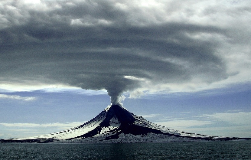
DISCOVER THE CAUSE OF THE LINK BETWEEN VOLCANIC ERUPTIONS AND HURRICANES

Now for the first time, scientists have explained how volcanic eruptions can influence hurricane formation.

Investigating this mechanism has so far been complicated, because in the era of sophisticated monitoring equipment, the largest volcanic eruptions have coincided with periods from El Niño-Southern Oscillation , which caused more hurricanes.

To solve this lack of data, scientists used detailed computer models to observe large numbers of eruption events that could affect hurricane formation around the world. These models found can influence the Intensity of hurricanes and their Frequency .

"This is the first study that explains the mechanism of how major volcanic eruptions influence hurricanes worldwide", said one of the researchers Suzana Camargo of Columbia University in New York.

The ITCZ ​​ plays an important role in the frequency and strength of Thunderstorms , which is where the link between Volcanoes and Hurricanes comes into play. The team of researchers found that these effects can be felt up to four years later.

As the world heats up, we need as much information as possible to understand how all of these meteorological events combine.

Predicting hurricanes is still a notoriously complicated business, with an almost infinite number of contributing factors involved. What we do know is that those huge storms can have a significant impact on people, animals, and property on their way.

The research has been published in PNAS .

source: Cerebro Digital.

RANGO EXTENDIDO DE PREDICCIÓN DE HURACANES PARA LA TEMPORADA EN EL OCÉANO ATLÁNTICO 2019

Anticipamos que la temporada de huracanes de la cuenca atlántica de 2019 tendrá una actividad ligeramente superior a la normal. El débil evento actual de El Niño parece probable que persista y quizás, incluso, fortalecer este verano / otoño. Las temperaturas de la superficie del mar promediadas a través del Océano tropical.
Las aguas del atlánticos están ligeramente por debajo de lo normal, y el extremo norte del Atlántico es anormalmente frío.
El índice de Oscilación Multi-decenal del Atlántico está por debajo de su promedio a largo plazo. Anticipamos un
probabilidad ligeramente por debajo de la media de los principales huracanes que llegan a tierra a lo largo del
costa continental de Estados Unidos y en el caribe. Como es el caso de todo huracán, se recuerda a los residentes de la costa que solo se necesita un huracán que llegue a tierra para que sea una temporada activa para ellos. Debemos preparar lo mismo para cada temporada independientemente de cuánta actividad se predice.

( 4 de abril de 2019)
Por Phil Klotzbach, del departamento de ciencias atmosféricas de la Universidad de Colorado.

PARA LA TEMPORADA DE CICLONES TROPICALES 2019
13 CICLONES TROPICALES CON NOMBRE (TORMENTAS TROPICALES).

QUE POR EVOLUCIÓN 5 DE ELLAS PUEDEN LLEGAR A HURACANES CATEGORÍA 1 Y 2.
Y 2 HURACANES DE GRAN INTENSIDAD, CATEGORÍA 3,4 O 5.

Recuerden, es solo un pronostico y no indica las zonas probables de impacto, solo un punto de referencia para las acciones de prevención.

FUENTE: Dirección General de Protección Civil y Bomberos.

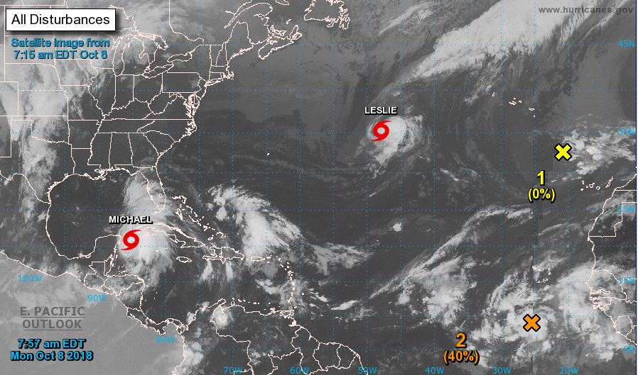
Atlántico activo

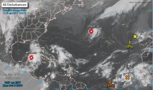
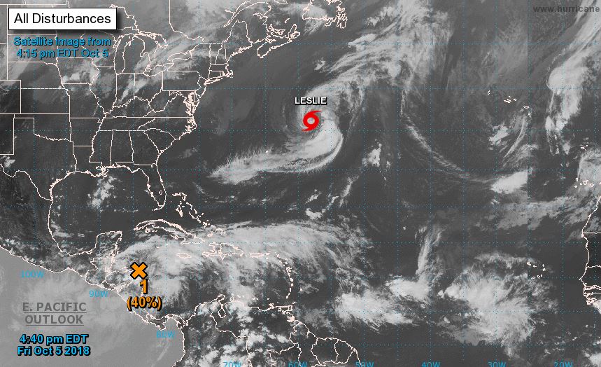
Área de baja presión 40%


Un área de baja presión, asociada a una onda tropical, se encuentra a varios cientos de millas al sur de las islas de Cabo Verde. La actividad de la lluvia y las tormentas eléctricas se ha vuelto más concentrada desde la noche anterior, y podría formarse una depresión tropical durante los próximos días mientras se mueve hacia el oeste-noroeste. Para el fin de semana, si embargo, se espera que los vientos de nivel superior se vuelven desfavorables para el desarrollo.

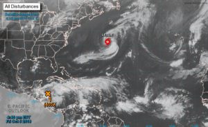
Es de prioridad tener las debidas precauciones ya que como podemos observar gracias al NOAA actualmente tenemos activo el Océano Atlántico.


Fuente: NOAA

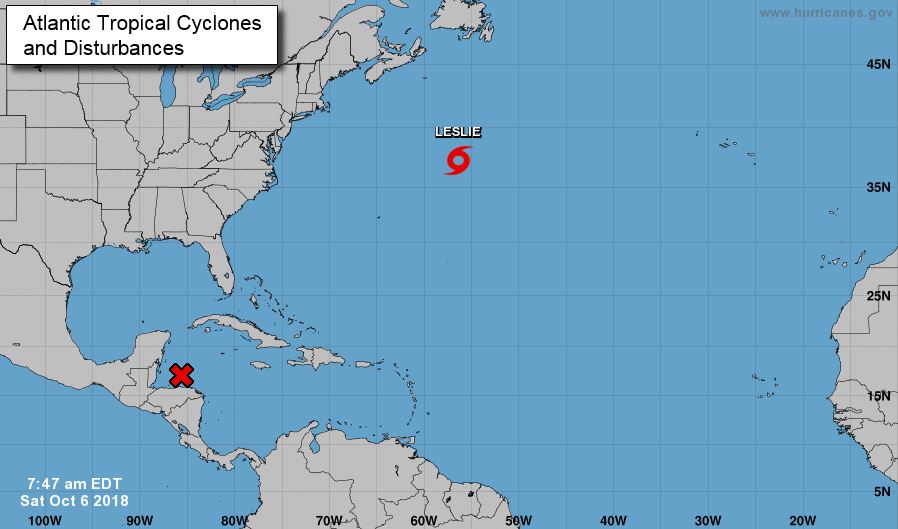
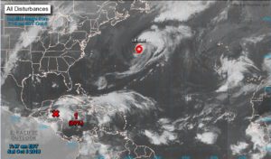
Formación ciclónica de 80%

Imágenes satelitales, observaciones de superficie y datos de radar de Belice indican que un área de baja presión está centrada justo al norte de la Isla de la Bahía de Honduras. Las lluvias asociadas y tormentas eléctricas muestran signos de organización ciclónica, sin embargo, el sistema aún no tiene una circulación bien definida.

Se espera que la depresión tropical o tormenta tropical se forme sobre el noroeste del Mar Caribe o el sur del Golfo de México este domingo o el lunes, mientras el sistema avanza lentamente hacia el norte.

La Península de Yucatán, Cuba occidental y la costa norte del Golfo de México debe monitorear el proceso de este sistema durante los próximos días. Independientemente de la formación de ciclones tropicales, esta perturbación continuará trayendo lluvias torrenciales a partes de Centro América, la Península de Yucatán y el oeste de Cuba en la próxima semana.

Fuente: NOAA

Probabilidad de formación ciclónica

Aumenta a 40% la probabilidad de formación ciclónica en los próximos 5 días. Actualmente esta zona de inestabilidad se encuentra en el Mar Caribe. Estaremos atento en los próximos días.

Una depresión tropical podría formase a finales de este fin de semana o a principios de la próxima semana en el noroeste Mar Caribe o Golfo de México mientras el sistema se desplaza hacia el noroeste hacia el norte.

Fuente: @HuracanesQRoo, NOAA.


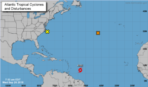
Tormenta Kirk

A partir de las 8:00am Miércoles 26 de septiembre (Aviso No. 10A)
Vientos máximos sostenidos: 83 km/h
Presión central mínima: 1004mb
Ubicada en: 12.0N 53.5W
Movimiento: oeste a 16 nudos; 33 km/h


Según el pronóstico realizado por el NOAA para los días domingo y lunes estaría aproximándose la Tormenta Kirk aún sin expectativas de que pueda llegar hasta Quintana Roo y sus alrededores, sin embargo, se les recomienda tener plan de emergencia preparado y contar con las medidas de prevención.

Un vistazo al mundo

Esto es impresionante ver el número de ciclones que hay en todo el mundo en estos momentos.

Entre ellos el Tifón Mangkhut de categoría 5 y el Huracán Florence de categoría 4

Es de gran importancia tengamos en consideración y sin perder de vista a la Tormenta Tropical (ISAAC) que actualmente se encuentra acercándose hacia Puerto Rico y que hay probabilidades que al continuar con su recorrido hacia la Costa de Yucatán pueda volver a tomar fuerza por los océanos cálidos que actualmente se presentan.


Fuente: NOAA

Fuente:Catástrofes Mundiales