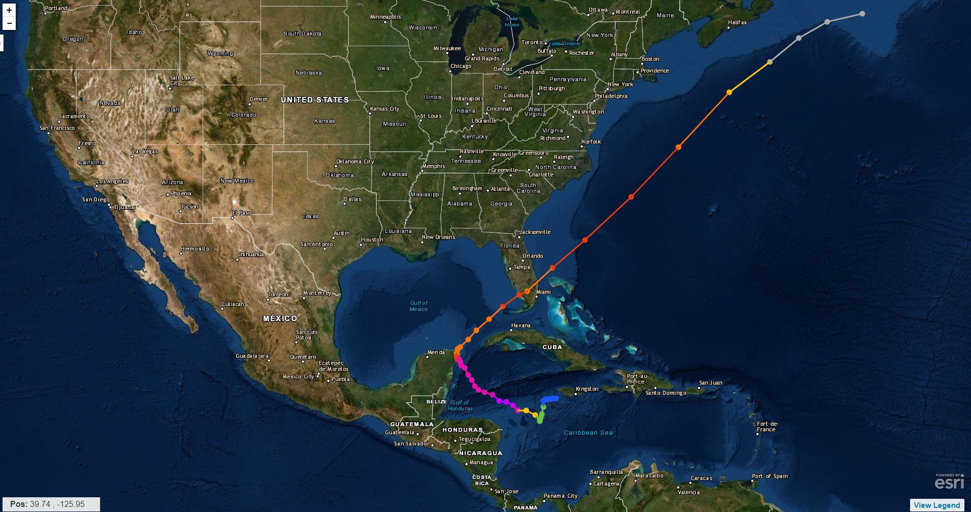
Hurricane Wilma 2005

The fierce hurricane made landfall in Mexico and tests the comprehensive prevention plan.

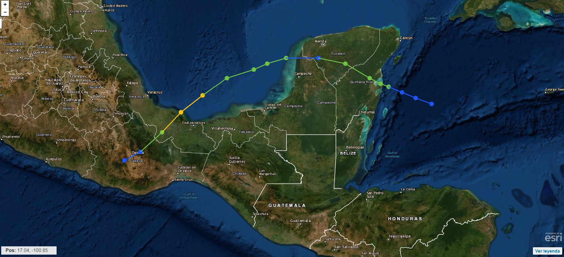
On October 21, 2005 Hurricane Wilma made landfall off the coast of Quintana Roo. With sustained winds that reached 280 km / h , it left one million victims in the country and economic losses of 30 million pesos , according to official figures.

The threat of the hurricane that gained brutal force in just 24 hours, going from category 2 to category 5 , with maximum sustained winds of 280 km / h this was something that really impacted everyone.

The phenomenon affected our country, where it claimed 4 victims, as well as Haiti, leaving 12 dead ; Cuba likewise 4 dead ; the Bahamas one person died from his attack ; and the United States left a balance of 3 1 dead.
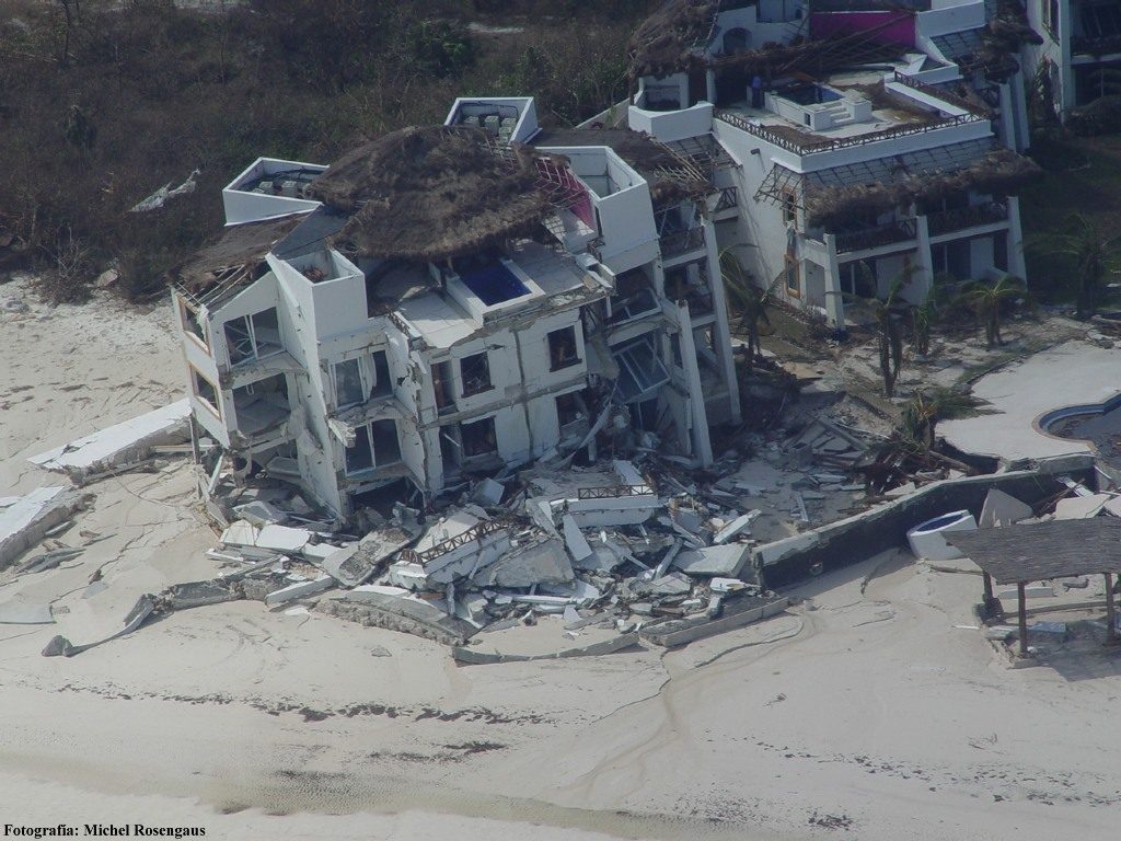
A residence in the Hotel Zone, Cancun, Q. Roo.

"There is a terrible wind, the few trees that were already fell, blown away by the wind, only one radio is transmitting information, that of the City Council, but the antenna is getting worse and worse and it can fall at any time"

Edna del Valle, living in the Miramar Poniente neighborhood for MORE THAN 10 YEARS.

Hurricane Stan 2005

It leaves more than 40 dead in Central America and Mexico.

It was then that the authorities of the States of Veracruz , Tabasco and Tamaulipas declared themselves in a state of maximum alert, issuing the call to the population to take refuge in the reception centers before the imminent arrival of tropical storm Stan , turned into Category 1 Hurricane , according to the scale of Saffir-Simpson . While in Central America, Stan has left 40 dead and more than 17,000 victims.

Winds reached sustained winds of up to 120 km / h , with more intense gusts, according to NOAA data ( National Hurricane Center ). The tropical storm combined with a cold front and caused severe damage in the north of Veracruz affecting some 170 municipalities , 800,000 people and 21,000 homes. >

In the Mexican territory, torrential rains caused floods in Yucatan and Campeche, causing the evacuation of 1,000 people and the total closure of schools in Chiapas. While in the state of Tabasco, the authorities were kept alert by the threat of heavy rains.

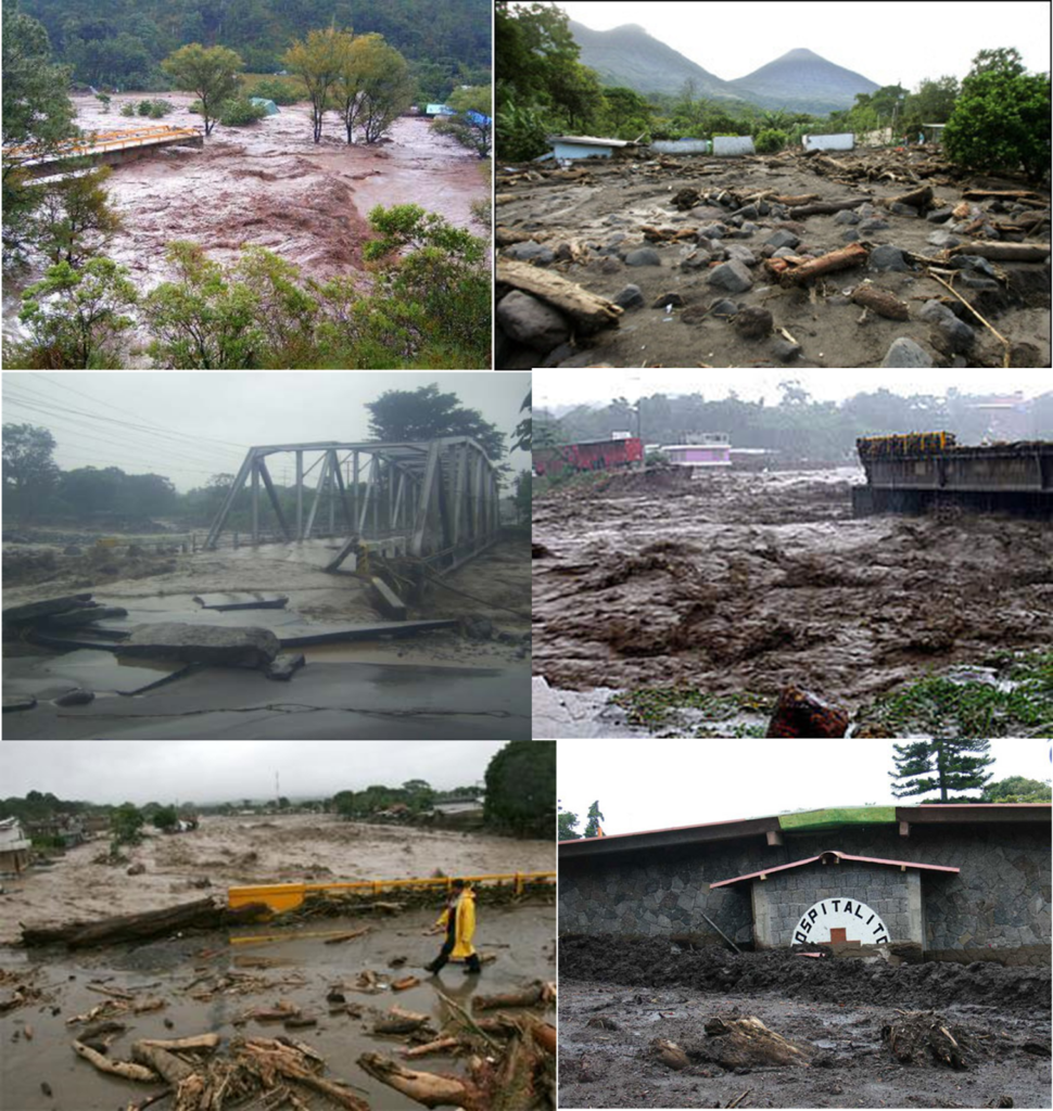
 Photographs of damage caused by Hurricane Stan in El Salvador.

TESTIMONY

Isidoro Trinidad

“This that just happened began on October 4 the rain as it was supposed to, but it was increasing and increasing, the rain day and night and we thought that it was going to stay that way, because it had happened on past occasions, but this time the river level increased and did not stop; in previous years the increase in the level of the river had already occurred and that is why we trusted ourselves; it was so that when we least realized the truth I had nowhere to run and we saw that the houses closest to the river were taking them away; The days went by and the level increased until we were forced to leave ... we lost everything. "

What is an Extratropical Cyclone?

Es un sistema atmosférico cuya fuente primaria de energía es el gradiente horizontal de la temperatura. Los ciclones extratropicales son sistemas de baja presión asociados a frentes fríos, cálidos o ocluídos. Los ciclones tropicales, a diferencia de los extratropicales, no manifiestan un gradiente horizontal de temperaturas tan sustancial en todo el diámetro de la tormenta, a nivel de la superficie, y sus vientos son generados por la liberación de energía durante la formación de las nubes y la lluvia; estos se componen por dos o más masas de aire (cálido o frío), por lo tanto se asocia a uno o más frentes.

The upper diagrams show horizontal maps of surface temperature, pressure, and wind fields associated with a tropical cyclone (left) and an extratropical cyclone (right) . Colors indicate temperature (blue 15 ° C = 59 ° F, green blue 20 ° C = 68 ° F, green 25 ° C = 77 ° F). Dashed lines indicate surface wind speeds: 34 kt = 39 mph = 63 kph, 64 kt = 74 mph = 117 kph, and 96 kt = 110 mph = 174 kph. Continuous lines are the isobars.
The diagrams below show maps of vertical pressure surfaces, temperature anomalies, and surface circulation and tropopause.

The strongest winds in a tropical cyclone occur near the earth's surface, while in an extratropical cyclone the strongest winds occur near the tropopause (at a height of 12 km (8 miles). These differences arise as a consequence of that the tropical cyclone has a "warm core" in the troposphere (below the tropopause), while the extratropical cyclone has a cold core in the troposphere and warm in the stratosphere (above the tropopause). The expression "warm core" it means that the center of the cyclone is warmer than the environment at the periphery of the storm, on the same isobaric surface (speaking of isobaric surfaces is like speaking of heights from the ground). Contribution Stan Goldenberg source: NOA

Barbara escalates to powerful Category 4 hurricane

Climate change in action?


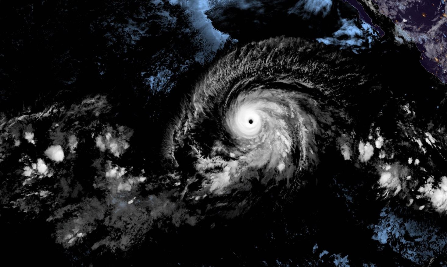
Tropical Storm Barbara in the Pacific Ocean quickly became a Category 4 hurricane and developed, achieving a record time of less than 24 hours. This fact leaves a strong message that the rapid development of these systems must be monitored even more today as there is increasing speed and intensity.

It is a great hurricane , fortunately it will not impact national terrain, however, there is vigilance for Hawaii .

source: catastrofesmundiales.com