


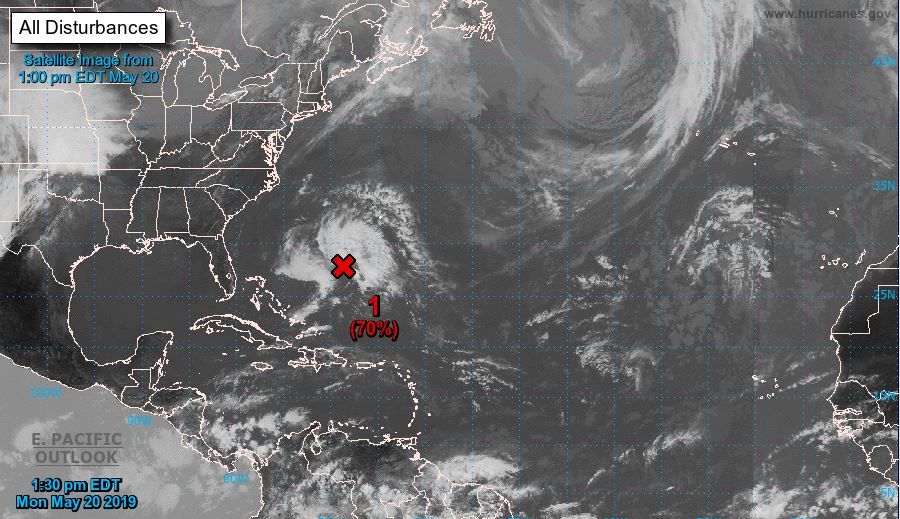
North Atlantic... Caribbean Sea and Gulf of Mexico:
Showers and thunderstorms associated with a broad low-pressure area located several hundred miles southwest of Bermuda are starting to show signs of organization.
Although recent satellite wind data indicates that the system doesn't yet have a defined circulation center, conditions are expected to become favorable for the development of a short-lived subtropical or tropical cyclone, possibly later today or tonight.
However, by late Tuesday, environmental conditions are expected to become less favorable, and the disturbance is likely to merge with a cold front by Wednesday.
A Reserve Air Force reconnaissance aircraft is currently en route to investigate the disturbance. Anyone in or near Bermuda should keep a close eye on updates regarding this system.
The next Special Tropical Weather Outlook will be released today at 8 PM EDT.
-
Chance of formation in the next 48 hours: high – 70%
-
Chance of formation in the next 5 days: high – 70%
Source: NOAA