


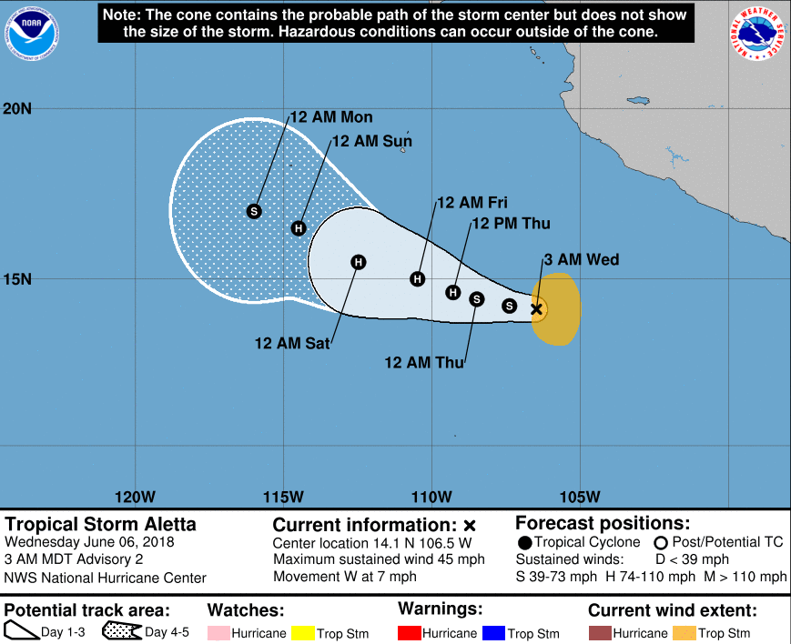
Tropical Storm ALETTA
As of 3:00 AM MDT, Wednesday, June
Maximum sustained winds: 40 knots (45 mph)
Minimum central pressure: 1000 mb
Location: 14.1°N, 106.5°W
Movement: West at 6 knots (7 mph)
Storm Details and Forecast
This chart shows an approximate representation of coastal areas under various alerts:
-
Red: Hurricane warning
-
Pink: Hurricane watch
-
Blue: Tropical storm warning
-
Yellow: Tropical storm watch
The orange circle marks the current position of the tropical cyclone’s center.
The black line (when selected) and the dots along it show the forecast track from the National Hurricane Center (NHC) at specific time intervals.
The dot representing the forecast center will be black if the system is expected to remain tropical, and white with a black outline if it is forecast to become extratropical.
If only the letter "L" is shown, the system is expected to become a remnant low.
Each letter in the dot indicates the forecasted intensity level:
-
D – Tropical Depression (winds under 39 mph)
-
S – Tropical Storm (winds between 39–73 mph)
-
H – Hurricane (winds between 74–110 mph)
-
M – Major Hurricane (winds above 110 mph)
Source: NOAA