What is an Extratropical Cyclone?
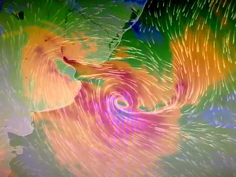
Es un sistema atmosférico cuya fuente primaria de energía es el gradiente horizontal de la temperatura. Los ciclones extratropicales son sistemas de baja presión asociados a frentes fríos, cálidos o ocluídos.
Los ciclones tropicales, a diferencia de los extratropicales, no manifiestan un gradiente horizontal de temperaturas tan sustancial en todo el diámetro de la tormenta, a nivel de la superficie, y sus vientos son generados por la liberación de energía durante la formación de las nubes y la lluvia; estos se componen por dos o más masas de aire (cálido o frío), por lo tanto se asocia a uno o más frentes.
The strongest winds in a tropical cyclone occur near the earth's surface, while in an extratropical cyclone the strongest winds occur near the tropopause (at a height of 12 km (8 miles). These differences arise as a consequence of that the tropical cyclone has a "warm core" in the troposphere (below the tropopause), while the extratropical cyclone has a cold core in the troposphere and warm in the stratosphere (above the tropopause). The expression "warm core" it means that the center of the cyclone is warmer than the environment at the periphery of the storm, on the same isobaric surface (speaking of isobaric surfaces is like speaking of heights from the ground).
Contribution Stan Goldenberg
source: NOA
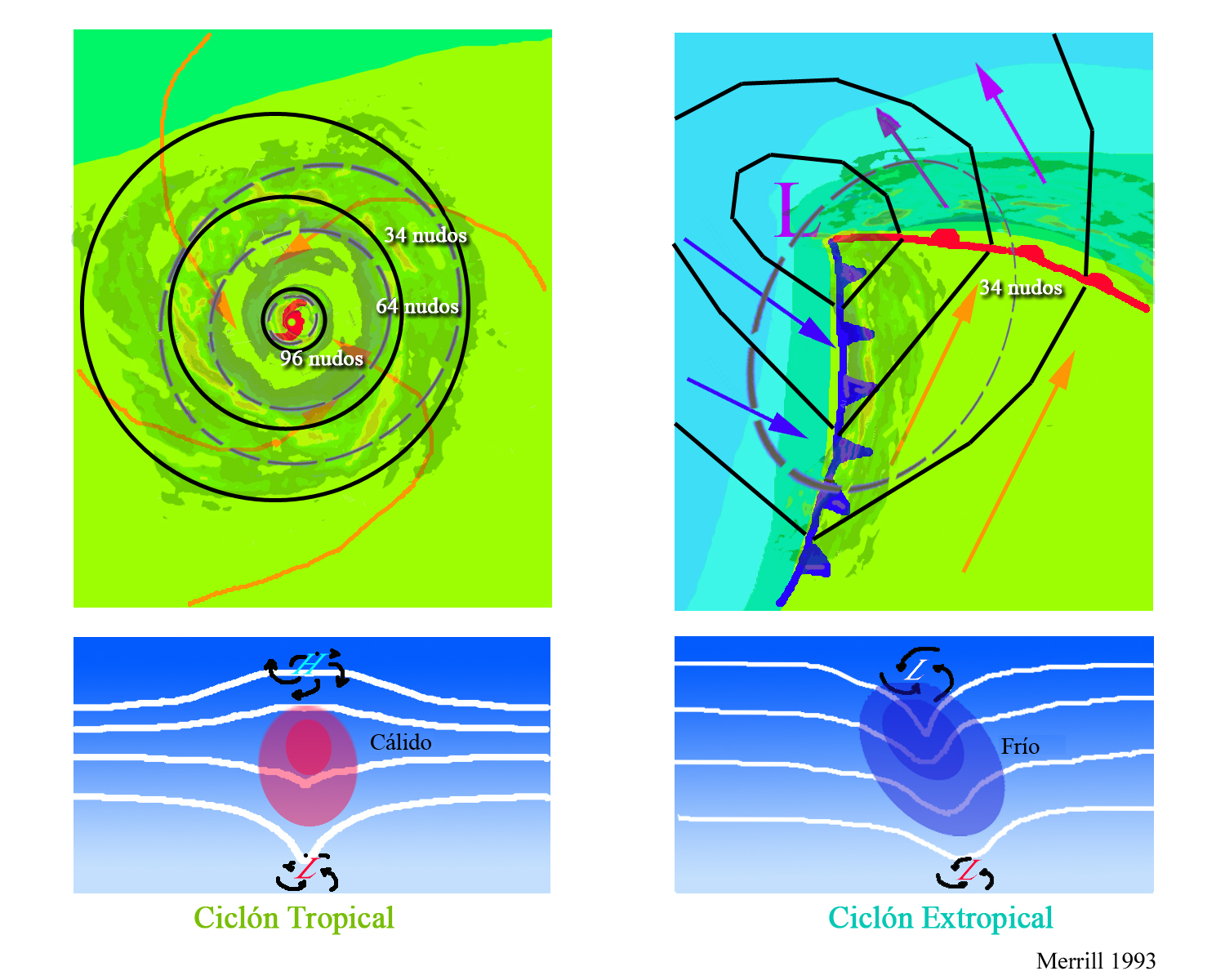 The upper diagrams show horizontal maps of surface temperature, pressure, and wind fields associated with a tropical cyclone (left) and an extratropical cyclone (right) . Colors indicate temperature (blue 15 ° C = 59 ° F, green blue 20 ° C = 68 ° F, green 25 ° C = 77 ° F). Dashed lines indicate surface wind speeds: 34 kt = 39 mph = 63 kph, 64 kt = 74 mph = 117 kph, and 96 kt = 110 mph = 174 kph. Continuous lines are the isobars.
Comments for this post are closed.