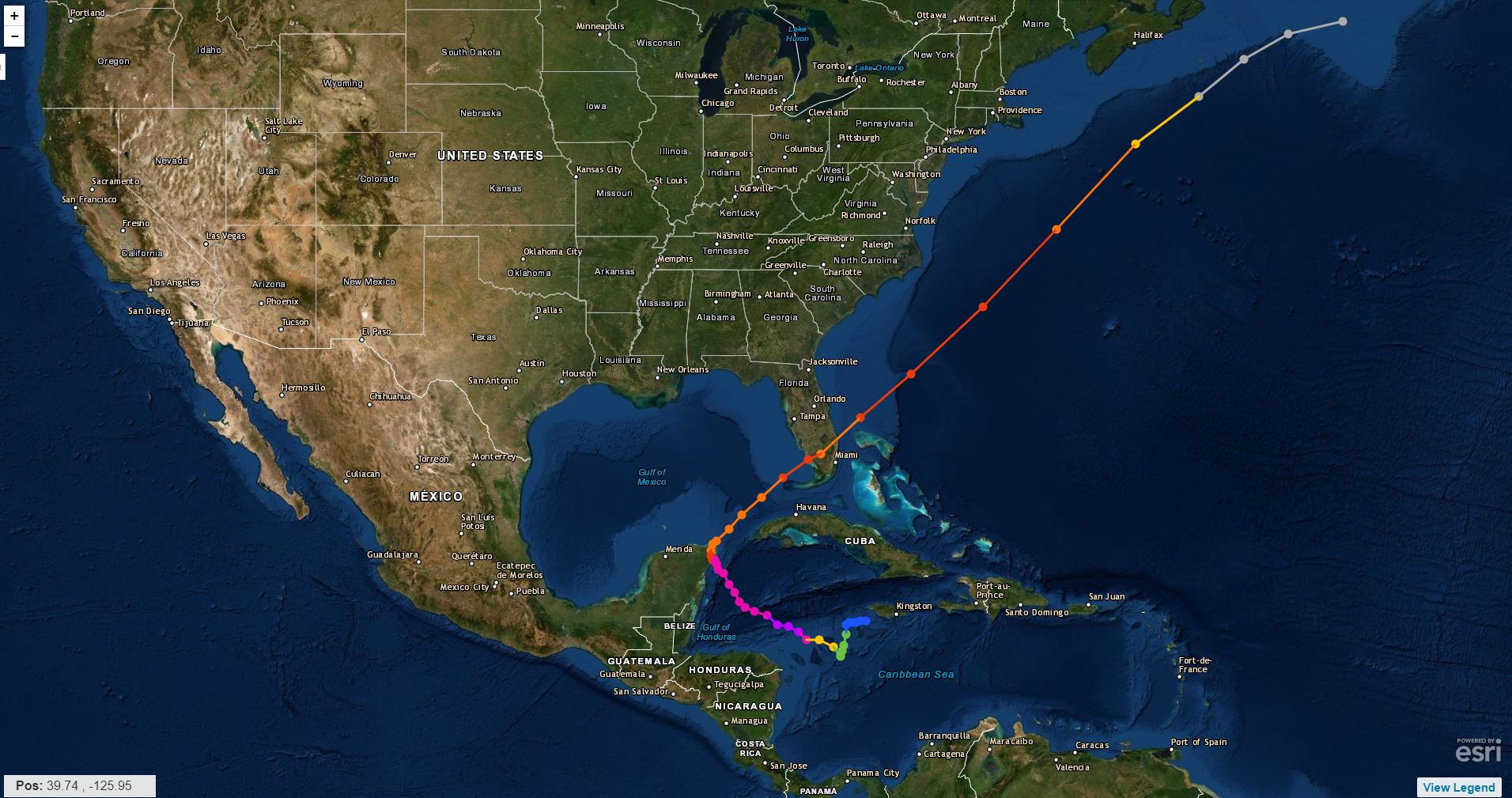
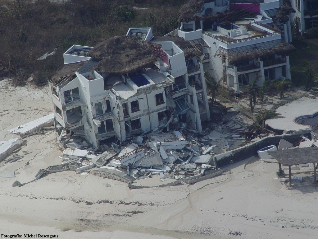
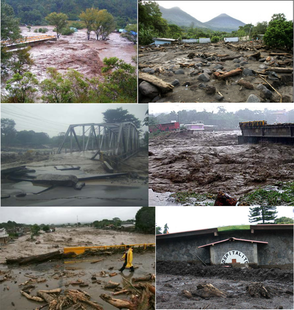
HOW CAN HUMANS INFLUENCE THE INTENSITY OF HURRICANES?

In the las decades, numerous studies have suggested that global warming could increase the number and intensity of tropical cyclones. However, recent research has shown that human emissions of greenhouse gases should already have caused a small increase on the intensity of tropical cyclones worldwide. But while there has been an increase in greenhouse gases in the atmosphere and the oceans have clearly warmed in recent decades, the global trend in the strength of tropical cyclones, does not coincide with the increase in these factors.

SCENARIO

In the view of this large puzzle of factors with big uncertainties that influence the potential intensity of tropical cyclones, NOAA produced simulations considering four different scenarios:

  • What happens if we had never started burning fossil fuels (without greenhouse gases, without aerosols?
  • What happens if we emit greenhouse gases, but not aerosols?
  • What happens if we emit aerosols, but not greenhouse gases? and
  • What is the scenario considering greenhouse gases and aerosols?

Beginning with the simplest scenario: if we hadn´t experimented with burning fossil fuels, the sea surface temperature and the potential intensity of the cyclones would have remained approximately the same approximate since 1850 until now. But if we look at what happens with the greenhouse gases and aerosols, so, the reality scenario 4) the surface sea temperature has clearly increased, but the potential intensity of the tropical cyclones has not. It has fluctuated slightly but we have not seem the same clear upward trend in the sea surface temperature until the past 2 decades. When we look at scenarios 2 and 3 things get very interesting. The computer model shows that the warming the warming provided by the greenhouse gases at the sea surface temperature is 2 to 3 times greater than the cooling effect of aerosols.

However, the increase in the potential intensity caused by the greenhouse gases is almost the equal to the decrease caused be aerosols.

In spite of the aerosols action, acting against greenhouse gases effects, the published study in the magazine “Natural Hazards” showed that, in the absence of a strong decrease of these gases emissions, the potential futures strength of greenhouse gases will dominate each time more the impact of aerosols, which will lead to substantially major increase in the intensity of tropical cyclones.

When we look at scenarios 2) and 3) things get very interesting. The computational model shows that the warming provided by greenhouse gases at sea surface temperature is two to three times greater than the cooling effect.

Creditos: Meteored.com.ar

Hurricane Dorian forecast: Errors and achievements

Dorian devastated everthing he found from The Bahamas to Canada. The national Hurricane Center studied the strom´s formation and development, and how well meteorologists predicted its trajectory and intensity.

What was the verdict?

Dorian became a tropical storm on August 24, 2019 in the middle of the Atlantic Ocean, crossed the Eastern Caribbean Sea, passing through the Virgin Island and Puerto Rico. But this was just de beginning of a journey that would last 15 days and would leave thousands of victims.

The Trajectory

The storm started as a small disturbance in the Caribbean area with dry air, which tends to weaken possible hurricanes. The European numerical model, the most reliable in recent years, could not predict its genesis and the GFS model predicted that it would form much further east. Also, when the storm began to take shape, forecasters did not agree on where the center of the storm would be. "Dorian´s forecast was extremely difficult because we were tracking 3 centers" said the specialists.

One of the first paths for Dorian was that it was going to cross over “La Española” and “Puerto Rico” where it was expected for the mountains to dissipate the storm. Another forecast showed him going to Florida. The surprise came when Dorian formed and turn to the right interacting with warmer water. Thanks to this, the storm was able to quickly intensify into a hurricane, resulting in a lack of warning, which would have been necessary for some of the islands at its path, according to the report.

The intensification

After the consolidation stage, forecasters were able to predict the storm´s trajectory without major difficulties. However, they failed in determining its intensity. There was no indication that it would strengthen into a Category 5 storm with sustained winds of 180 m/h, even less that it would stop at the Bahamas for several hours.

Another big dilemma for the meteorologists was whether or not to issue warnings for The Florida. Forecasts showed that the storm´s trajectory was heading north, avoiding the state. But taking into consideration previous mistakes, there were great doubts. They saw an advantage in what had not been able to predict. The storm was not moving fast, and if it deviated from the predicted trajectory, there would be time to issue warnings.

In the end, Dorian effectively took a turn northward as planned, and this successful forecast saved Florida residents and its government a lot of money on unnecessary evacuations.

Be a Force of Nature.

Every year, people in this country and in many others are killed or seriously injured by all kinds of extreme weather, despite previous warnings. 

In StormCatcher we develop community resilience in the face of increasing vulnerability to extreme weather and water events. As part of the Weather-Ready Nation iniciative, NOAA and along with its parrtners wants to motivate individuals and communities to take actions that will prepare them in the event of a weather disaster.

However, NOAA and its partners can´t do it alone. A key member of the team is the public. That is why we are encouraging everyone to do their part. We ask everyone toBe a Force of Nature“.

Be a Force of Nature by knowing your risk, taking action and being an example in your community.


KNOW YOUR RISK

Hurricanes, droughts, tornadoes, snowstorms, flooding - severe weather impacts every part of the country. The first step to becoming weather-ready is to understand the type of hazardous weather that an affect whaere you live and work, and how the weather could impact you and your family. What you can do.

  1. Stay informed of the latest CONAGUA weather forecast.
  2. Follow official information media such as the National Weather Service Facebook  y Twitter.
  3. Develop an eviction plan.

TAKE ACTION

Be a Force of Nature by making sure that you and your family are prepared for severe weather. This includes creating a disaster supplies kit and making sure that you can receive emergency messages. 

  1. Prepare a supply kit. Make a list of items to replenish your hurriane supplies and start getting them before hurricane season begins. 
  2. Get verification of your insurance. Keep inmind that homeowne´s insurance policies do not include flood coverrage. Flood policies require a 30-day waiting period!
  3. Strenthen your home. Make sure it is under lical building codes. Remember, the garage door is the most vulnerable part of the house, and it needs to be able to resist strong winds. 

BE AN EXAMPLE

Be a positive influencie on your community b sharing your weather preparedness story. "Be a Force of Nature" by letting your friends and family kwon what you did to become weather-ready it is very important to ask your friends and family if they are already prepared. What you can do.

  1. Ask your friends and family if they are ready. On many occasions it happens that our close relatives have not prepared, so it is important to share your actions to take.
  2.  Help your neighbor. Many people, and especially the elderly, depend on the assistance of their neighbors before and after the hurricanes.
  3. Complete yout written plan. Writing a plan will help you avoid mistakes when you face an emergency and will ensure that everyone in your home is prepared for the next storm.

Credits: NOAA

uncapped heroin from Hurricane Dorian.

Chella Phillips saved 97 dogs from dying.

As everyone knows The Bahamas has been viralized by that intense hurricane Dorian , a hurricane that will undoubtedly go down in history as one of the most devastating hurricanes so far in the Hurricane Season 2019 . You know now that the passage of the hurricane destroyed people's homes, flooded the streets and caused the death of at least five inhabitants.

Given the authorities' warning that the weather phenomenon would hit the Caribbean islands, residents prepared as best they could, bought groceries, and took refuge in shelters or their homes. But a woman named Chella Phillips worried not only about keeping her safe, but about street dogs that would have no place to shelter.

He opened the doors of his home to 97 ownerless canines so that they could be safe during hurricane storms.

CHELLA PHILLIPS.

Chella Phillips had to share her room with 79 dogs, but that was the easiest part of having rescued them. Keeping them and their brother who accompanied her in their shelter safe was difficult. The first night Dorian's eye fell on the Bahamas, rain began to flood his home. They used three pumps to drain the water but it was not enough and the liquid exceeded them . After an hour of relentless trying, all of the machinery had overheated and burned, so they had to try to scoop the water out, but they failed entirely.

They ran out of services and their TV broke down from the lightning of the storms that hit the area, so she couldn't use the cartoons to entertain the dogs that were inside her house, and she won't be able to do until you get a new one.

Despite the complications experienced, the Chella was able to keep the 97 dogs safe, with food and water.

Phillips is the director of The Voiceless Dogs of Nassau, a dog shelter in the Bahamas. "I am not affiliated with the Humane Society nor do I receive any kind of government aid. Only me and my love for these homeless dogs is what I do ", he says in the description on his Facebook page.

For eleven years, when she moved to the archipelago, she has been dedicated to helping street animals and four years ago she opened the refuge. During that time, with his own money and donations, he has managed to help 1,000 street dogs.

Who says that a Tropical Storm is not dangerous?

Who says that a Tropical Storm is not dangerous?

Many people normally when listening to "tropical storm" think that it is not something to which we must attribute so much attention or that represents a danger to our family or that threatens our home and / or business, we simply pay attention to it when we find out of the approach of a hurricane; but big mistake, this time this is an example of a tropical storm that triggered tragedies.

The tropical storm #Fay on August 15, 2008 penetrating from the east and leaving from the south (Haiti). Fay the sixth tropical storm of that Atlantic Hurricane Season , has already left victims. A woman has drowned and her two children have disappeared when a stream overflows in the municipality of Higuey, in the east of the Dominican Republic, due to the intense rains caused by the tropical storm " Fay ".

The heavy rains that fell on the Dominican Republic and kept much of the nation on high alert, 2,230 people were forced to take refuge in shelters in the capital of the country, Santo Domingo, and affected 446 homes. Throughout the day, the storm Fay was then that it began to move towards Haiti.

Arroyo “Chau Chau”

The 32-year-old fatality lost his life when he and his husband and two children attempted to cross the overflowing “Chau Chau” stream in a vehicle. The husband survived, but his two children were taken from him and swept away by the current ...

The director of civil defense reported

Hurricane Manuel 2013

Although it was only category 1 , Manuel left 123 dead , 97 of them occurred in an avalanche in the community of La Pintada, Guerrero . It was also brutalized with Coahuila , Chihuahua and Durango . In addition, there were more than 59 thousand evacuees and at least 218 thousand 594 people affected . Economic losses were estimated at $ 242 million .

On September 13 in the morning the tropical depression No. 13 of the Pacific Ocean was generated, which was formed from a low pressure off the coast of Guerrero that finding favorable conditions led to a tropical depression Thirteen , which started with sustained winds of 55 km / h , gusts of 75 km / h and moving northwest at 6 km / h .

During the day 14 , the tropical storm " Manuel " began with a stationary period and then began its course heading north, moving smoothly erratic while increasing its strength off the coast of Guerrero and Michoacán , causing a wide area of ​​dense cloudiness, whose rotation favors the significant entry of moisture into the southern and western states of the country.

On September 15 , around 2:00 pm, the tropical storm " Manuel " made landfall over the City of Manzanillo, Colima with maximum sustained winds of 100 km / h and gusts of 130 km / h , when advancing on land, the system began to lose strength due to which at 22:00, was already in the vicinity of the population of El Limón, Jalisco, as a tropical depression with maximum sustained winds of 55 km / h , gusts of 75 km / h and moving northwest at 13 km / h

At 01:00 a.m. September 16 , the tropical depression " Manuel " was located 25 km northeast of Tomatlán, Jal ., moving northwest at 13 km / h, very close to weakening at low pressure. At 4:00 on the same day, DT “ Manuel ” was already at sea again as a low pressure remaining with maximum sustained winds of 45 km / h and gusts of 65 km / h.

The low pressure, remaining from " Manuel " continued its journey to the northwest and on September 17 in the afternoon, when it was 120 km west-southwest of Mazatlán, Sin., Regenerated to a tropical depression with maximum sustained winds of 55 km / h and gusts of 75 km / h , the same force with which it was maintained until morning of day 18 , when it developed for the second time in its path to a tropical storm, being 160 km south-southwest of Culiacán, Sin., with maximum sustained winds of 65 km / h and gusts of 85 km / h.

While gaining strength, the tropical storm “Manuel” began to enter the southern part of the Gulf of California and at 7:00 p.m. on the 18th, when it was 180 km south-southeast of Topolobampo, Sin., It intensified to hurricane acquiring maximum sustained winds of 120 km / h with gusts of 150 km / h , strength with which it was maintained until 19 September at noon, when it touched the Sinaloa coast; upon touching land, “Manuel” began to lose strength, so at 13:00 it was located 65 km north-northeast of Altata, Sin., as a tropical storm, with maximum sustained winds of 100 km / h and gusts of 120 km / h.

"It was very maddening because we didn't know what was happening, but when the energy came back it was worse because we knew that everything was closed and we couldn't leave Acapulco."

Esther Jiménez.

Hurricane Wilma 2005

The fierce hurricane made landfall in Mexico and tests the comprehensive prevention plan.

On October 21, 2005 Hurricane Wilma made landfall off the coast of Quintana Roo. With sustained winds that reached 280 km / h , it left one million victims in the country and economic losses of 30 million pesos , according to official figures.

The threat of the hurricane that gained brutal force in just 24 hours, going from category 2 to category 5 , with maximum sustained winds of 280 km / h this was something that really impacted everyone.

The phenomenon affected our country, where it claimed 4 victims, as well as Haiti, leaving 12 dead ; Cuba likewise 4 dead ; the Bahamas one person died from his attack ; and the United States left a balance of 3 1 dead.

A residence in the Hotel Zone, Cancun, Q. Roo.

"There is a terrible wind, the few trees that were already fell, blown away by the wind, only one radio is transmitting information, that of the City Council, but the antenna is getting worse and worse and it can fall at any time"

Edna del Valle, living in the Miramar Poniente neighborhood for MORE THAN 10 YEARS.

Hurricane Stan 2005

It leaves more than 40 dead in Central America and Mexico.

It was then that the authorities of the States of Veracruz , Tabasco and Tamaulipas declared themselves in a state of maximum alert, issuing the call to the population to take refuge in the reception centers before the imminent arrival of tropical storm Stan , turned into Category 1 Hurricane , according to the scale of Saffir-Simpson . While in Central America, Stan has left 40 dead and more than 17,000 victims.

Winds reached sustained winds of up to 120 km / h , with more intense gusts, according to NOAA data ( National Hurricane Center ). The tropical storm combined with a cold front and caused severe damage in the north of Veracruz affecting some 170 municipalities , 800,000 people and 21,000 homes. >

In the Mexican territory, torrential rains caused floods in Yucatan and Campeche, causing the evacuation of 1,000 people and the total closure of schools in Chiapas. While in the state of Tabasco, the authorities were kept alert by the threat of heavy rains.

 Photographs of damage caused by Hurricane Stan in El Salvador.

TESTIMONY

Isidoro Trinidad

“This that just happened began on October 4 the rain as it was supposed to, but it was increasing and increasing, the rain day and night and we thought that it was going to stay that way, because it had happened on past occasions, but this time the river level increased and did not stop; in previous years the increase in the level of the river had already occurred and that is why we trusted ourselves; it was so that when we least realized the truth I had nowhere to run and we saw that the houses closest to the river were taking them away; The days went by and the level increased until we were forced to leave ... we lost everything. "

Hurricane Paulina 1997

One of the deadly, destructive and expensive cyclones during the second half of the 20th century.

Paulina originated from a tropical wave on October 5, 1997 410 km south-southwest of Huatulco, Oaxaca. Initially it had an eastward shift, but then turned north-northwest. During the day October 7 , Paulina registered its maximum intensity reaching the category 4 on the scale of Saffir-Simpson with sustained winds of 215 km / h and gusts of up to 240 km / h . On the afternoon of October 8 , it made landfall near Puerto Escondido, Oaxaca, causing serious damage to the coast of that state. At dawn on October 9 , he parked in the state of Guerrero, leaving the port of Acapulco practically destroyed, Paulina would dissipate in the early hours of the day October 10 in the state of Jalisco.

Hard to believe but this image was taken in Acapulco, Guerrero.

Unusual

Entire families were engulfed by the flows that devastated the hills, whose slopes were covered with irregular settlements. The cardboard, wood and palm districts, many of them built on the banks of rivers and streams, disappeared entirely from the map.

No doubt he spent a full week in the midst of terror with the sense of survival triggered to protect yours and your own life.

Testimony

Paulina produced a torrential record rainfall in Acapulco of 411.2 mm accumulated in less than 24 hours. The floods severely affected leaving 230 to 400 people dead . Nearly 300,000 people were left homeless and damages of 80 billion pesos were recorded.

Hurricane Gilberto 1988

Gilberto the terrible hurricane of the 20th century

It is considered to be one of the most devastating cyclones on record in the Atlantic Ocean.

In Mexico, Gilberto lashed the states of Quintana Roo, Yucatán, Campeche, Nuevo León, Coahuila and Tamaulipas , causing the death of at least 250 people , and close to 150 thousand victims , as well as losses of 750 million dollars .

The hurricane known as the 20th century , was formed on September 8, 1988 as a tropical depression, during its movement through the Caribbean water It intensified into a Category 3 hurricane .

Foto: Unión Cancún

It struck the Island of Jamaica causing the death of 49 people , in addition to millionaire losses in infrastructure, as well as serious damage to crops

After leaving Jamaica, Gilberto quickly intensified again, reaching sustained winds of 296 km / h and made landfall again on September 14 in the Peninsula of Yucatan, being already a powerful Category 5 hurricane , being Cozumel the first affected, continuing its journey on land by Playa del Carmen, X-can, and Chemax , maintaining its same category 5 up to 85 kilometers inland .

Foto: Grupo SIPSE

It was until 3:30 p.m. that his intensity decreased to category 4 during his time at Tizimín . He left Yucatan at around 19:00 hours , leaving in his wake close to 35,000 victims , 60,000 homes destroyed and damages for more than $ 1 million .