Author: <span>David Maldonado</span>

IS YOUR HOME OR BUSINESS REALLY PROTECTED AGAINST THE FULMINATING FORCE OF A HURRICANE?

Is your home or business really protected from the sudden force of a hurricane?


Many people when asking this really believe that if they are protected and ready to react to the withering force of a hurricane, which we leave you…

Reasons why obtaining cyclonic protection is convenient for you and your family.

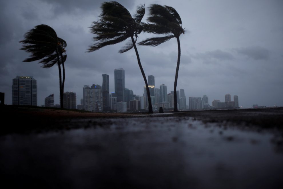
Living in a coastal region, it is important not to go unnoticed and to consider how dangerous the impact of a cyclone could be. When taking safety precautions it is easy to underestimate the amount of damage a hurricane can cause, however it is substantial that you take the time to prepare your family and property in the event of a storm.

The safety of yours is paramount, for this reason, we give you some reasons and / or recommendations why becoming a creditor of anticyclonic protection is a smart decision.


1.- PROTECT YOUR HOME DURING THE PASSAGE OF A HURRICANE

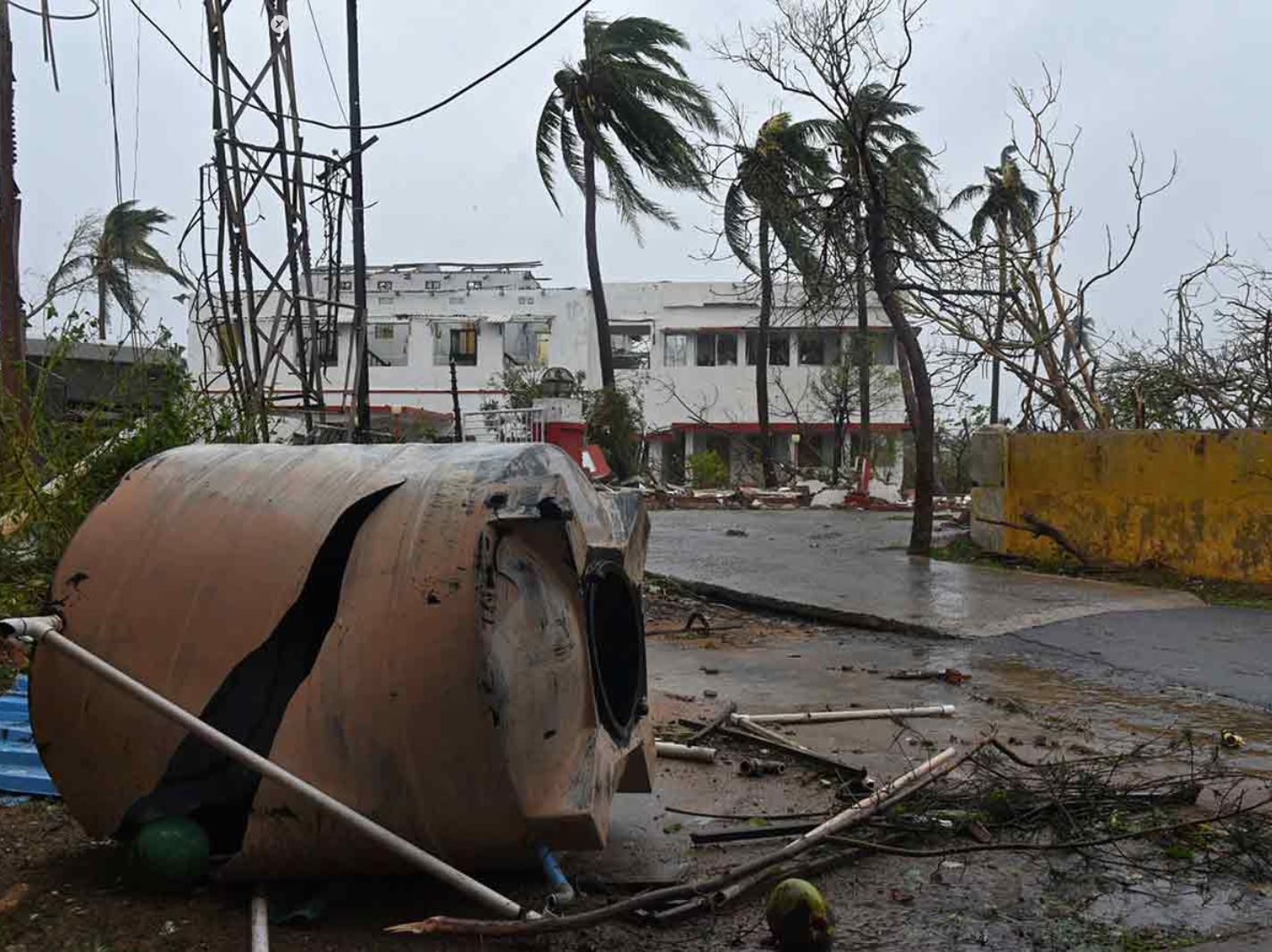
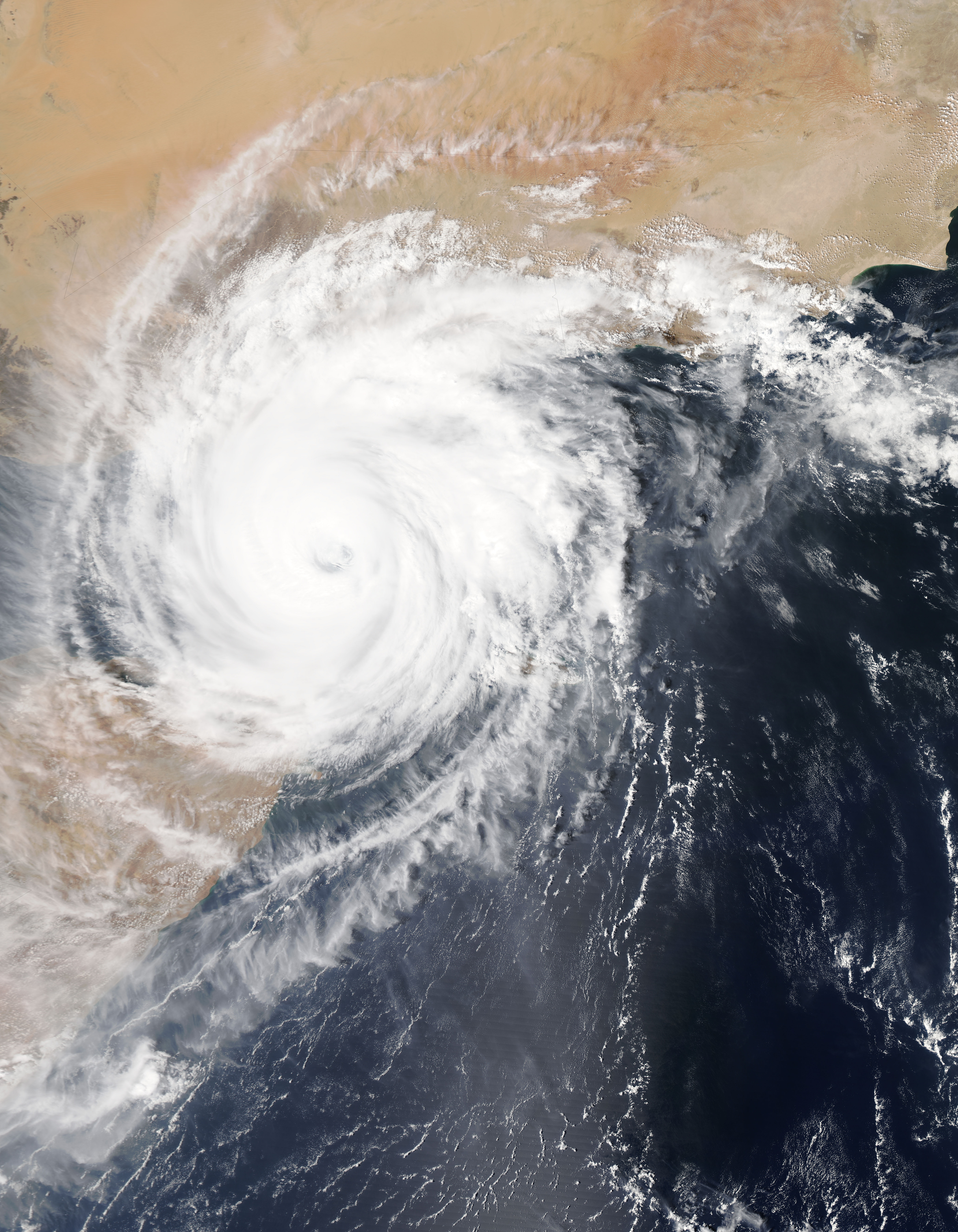
Hurricanes have been increasing in strength over the years due to global warming, which puts very great pressure on the windows that are exposed to it, and breaks them easily, leaving your property vulnerable to rains and debris that can cause significant damage to your home.

An anti-hurricane security system, keeps any possible threat off your property, keeping you and your family totally healthy and safe.


2.- EASY TO INSTALL

Stormcatcher en acción

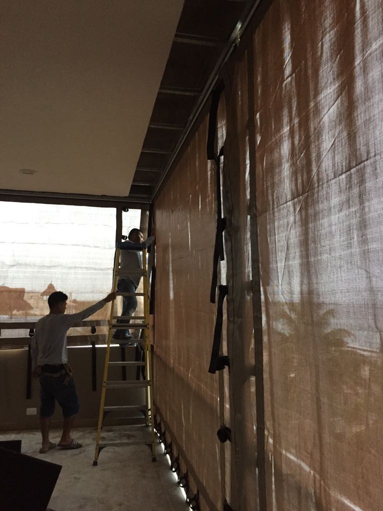
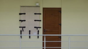
There are two types of anticyclonic systems ( temporary and permanent ) which are chosen depending on the preference of the client. Many times to take care of your facade or visually it looks great, since any modality protects.

In the case of temporary (polypropylene anticyclonic mesh, panels) they can be mounted and dismounted when the client needs it; On the other hand, the permanent such as aluminum blinds, folding aluminum, will be fixed to your window giving security whenever you require it.

3.- LONG-TERM BENEFITS

Compared to other forms of protection against hurricanes, such as impact windows or reinforced doors, the security benefit is acquired in the long term, since taking into account the low cost it has, it also resists much longer than other types of solutions .

The range of protections is very varied, as well as there are different factors which can make one type of protection more optimal than others, such as window measurements, location or community regulations.

Investing in a cyclone protection system is a decision that can provide future benefits, in short it is a smart decision.

Andrea forms, the first probable Caribbean Tropical Storm


For the North Atlantic ... Caribbean Sea and Gulf of Mexico: 1.

Showers and thunderstorms associated with a wide area of ​​low. Pressure several hundred miles southwest of Bermuda is showing signs of organization. Although recent satellite wind data suggests that the system currently lacks a circulation center, the environmental conditions are expected to be conducive.

For the formation of a short-lived tropical or subtropical cyclone. Later today or tonight. Conditions are expected to become unfavorable for further development by the end of Tuesday, and the disturbance is expected to merge with a cold front on Wednesday. A reconnaissance aircraft from the Air Reserve is currently en route To investigate the riot. Interests in Bermuda must Monitor the progress of this system. The next Tropical Special Weather Outlook will be issued today at 8 PM EDT.

* Possibility of training through 48 hours ... high ... 70 percent.

* Possibility of training through 5 days ... high ... 70 percent.


Fuente: NOA

HURRICANE SEASON BEGINS 2019 How many hurricanes are expected?

The hurricane season began today in the Pacific and in the Atlantic it will begin in June, both will end in late November of this 2019. The names of the hurricanes are recycled every six years.

For this hurricane season in the Atlantic this is the forecast.

Asimismo, se pronosticó Centro Nacional de Huracanes (NHC, por sus siglas en inglés) que en el Océano Pacífico habrán 24 huracanes, mientras que para el Atlántico prevé 21.


source: Sipse.com

12-14 storms forecast for Hurricane Season 2019

The density map of the above tropical trajectory was created by analyzing analog years, which are past years that have weather patterns similar to current and projected weather patterns. Analogous years are often used to predict future trends and impacts during a hurricane season. They can be based solely on the El Niño phenomenon or on a combination of weather patterns and teleconnections, which are weather patterns that occur in another part of the world and that can significantly influence current or future weather in a particular area of ​​concern.

Luego de vivir una activa temporada de huracanes en el Atlántico el pasado año, el grupo de expertos de AccuWeather pronostica que el 2019 será una temporada ligeramente superior a la normal con un total de entre 12 a 14 tormentas. De esas tormentas, se pronostica que de cinco a siete se convertirán en huracanes, y de dos a cuatro en huracanes categoría tres o más. “Este año, creemos que habrá menos tormentas tropicales y menor número de huracanes, pero solo se necesita una para causar daño significativo”, dijo el experto en huracanes de AccuWeather, Dan Kottlowski. Después de que los huracanes Michael y Florence afectaran los EE. UU. el pasado año, el experto señala que pudiese repetirse la historia con el impacto de entre dos a cuatro fenómenos atmosféricos en la región. Para ayudar a predecir la próxima temporada, los pronosticadores han establecido comparaciones con años anteriores con condiciones climáticas comparables, también conocidos como años análogos. En este caso, por su similitud, el año análogo al patrón actual es el 1969. Durante esa temporada, el huracán Camille impactó la región de Mobile, Alabama, convirtiéndose en uno de los tres únicos huracanes categoría 5 que han impactado los Estados Unidos. Pero eso no significa que experimentemos algo similar este año, dijo Kottlowski. Al comienzo de la temporada, sin embargo, los meteorólogos de AccuWeather estarán monitoreando el potencial de desarrollo en la costa sureste, el Golfo de México y el Caribe. “Esas son las áreas que vigilaremos muy de cerca, no solo a partir de junio, sino desde abril y mayo, pues las temperaturas del Atlántico se encuentran elevadas”, dijo el experto.

THE HURRICANE SEASON IN THE ATLANTIC OFFICIALLY STARTS JUNE 1

If this [El Niño] pattern continues or strengthens, then the number of tropical storms and hurricanes will be near or below normal, "said Kottlowski. "If El Niño weakens and becomes neutral, the number of tropical storms and hurricanes could be higher than normal," he added. source: AccuWeather

WHAT IS A "ZOMBIE HURRICANE"?

Accu Weather first alerted to this phenomenon.

Cancun.- When Hurricane Leslie threatened the Canary Islands last September, meteorology expert Dan Kottlowski found that the data and forecasts described a zombie hurricane or dying.

The company AccuWeather, specializing in climate, immediately used the term to define a cyclone with no definite or predictable course .

Thus, ' zombie hurricane ' is understood to mean a phenomenon that, despite the clues obtained by satellite and other instruments, scientists do not reach a general consensus on the place of impact, its level of force and, above all, its life time.

Leslie, the zombie hurricane, hit Portugal on October 14, 2018

According to the Spanish ABC, Kottlowski considered Leslie as a z zombie hurricane ’because in 2018 she did not know when she would die.

And it is that Leslie meandered the Atlantic for more than 10 days surviving hot and humid waters and weather systems that could not stop him. The phenomenon finally impacted the coasts of Portugal. That would be the first time that a cyclone of that category and force had touched that region since 1842.

source: Sipse.com

THE WORST CYCLONE IN INDIA LEAVES AT LEAST 3 DEAD (video)

Cyclone Fani is considered the most powerful in the past 53 years.

INDIA.- This cyclone Fani, considered the most powerful cyclone that has rocked India in the last 43 years , reached the east coast near the city Puri (Odisha state), leaving at least three dead, they report local media.

According to RT, the phenomenon has uprooted hundreds of trees in its path, causing serious damage to energy infrastructure and homes. According to the media The Hindu, storm winds already reach 175 kilometers per hour.

Watch the AWESOME video! Click -> Here

At least 10,000 villages and 52 cities in nine districts will be affected by the meteorological phenomenon , according to data from the Odisha Government, which has advised the population to stay inside their homes on the day of this Friday.

Airports located on the cyclone route are being closed, while flight operations from Odisha's capital Bhubaneswar airport have been suspended since midnight on Thursday.


source: SIPSE.COM

MEXICAN AUTHORITIES DECLARE READY TO FACE HURRICANE SEASON 2019

This Thursday a simulation was carried out at Cenapred on the hypothesis of a category 5 hurricane off the coast of Guerrero; the rainy and cyclone season begins on May 15.


As a successful, formative and confidence-building exercise, the head of the Civil Protection National Coordination, David León Romero, described the drill carried out this Thursday at the National Center for Disaster Prevention ( Cenapred ), on the hypothesis of a Category 5 hurricane on the coasts of Guerrero.

In this way, the National Emergency Committee declared itself ready to face the rainy and hurricane season that begins on May 15 and concludes on November 30 in the country.

In the simulation of the supposed hurricane "Viridiana", which lasted 3 hours and 40 minutes, 52 specialists from 38 agencies participated in the processing of information, analysis, decision-making and creation of solutions

During the civil protection exercise, two damage assessment and needs analysis reports were issued, two links with the National Center for Communication and Emergencies, and 36 messages were prepared for the coordination of actions.

" During this drill, we particularly had some scenarios of river overflow, collapse of some structures, floods, evacuations in buildings, particularly health, road closures due to bridge collapses, that is, different scenarios that my colleagues and I had to be solving throughout those minutes to be able to provide answers to this table and with it to be able to measure the response capacity of these institutions ”, explained David León Romero.

Autoridades se declaran listas para afrontar temporada de huracanes

The head of the National Coordination of Civil Protection highlighted that some areas of opportunity they found to improve care are the use of new technologies for handling and processing information in real time with greater agility and strengthening the communication protocol with the media to avoid rumors or false news on social networks.

He recalled that hydrometeorological phenomena consume 80% of the budget allocated to emergency care, since just last year 214 events were registered, of which 41 were tropical cyclones and of them, 6 touched the country.

source: Excelsior

2019, A YEAR WITH A LARGE NUMBER OF EXTREME METEOROLOGICAL PHENOMENA

The rainy season and tropical cyclones will begin on May 15, according to experts.


Mexico.- This year in the Pacific seas a weak El Niño phenomenon will be registered, which will generate a large number of extreme weather events and we must be ready to face them, warned Blanca Jiménez, director of the National Water Commission (Conagua).

During her participation in the inter-institutional meeting held at the National Center for Disaster Prevention (Cenapred), the environmental engineer stressed that we must be prepared for the imminent rainy season and tropical cyclones, which will begin on May 15 and end on November 30.

In order to establish the most appropriate lines of action to be applied before, during and after of a possible emergency, the proposal is to work, in a coordinated manner and putting aside any partisan affiliation, between the three levels of government , as well as establishing closer and closer communication with the population, added David León Romero, national coordinator of Civil Protection.

According to UNAM Global, to consolidate this strategy, the so-called Inter-institutional Analysis and Coordination Group for Tropical Cyclones was established, consisting of:

  • Ministry of Public Security (SSP)
  • Ministry of Communications and Transportation (SCT)
  • Ministry of the Environment and Natural Resources (SEMARNAT)
  • Ministry of National Defense (SEDENA)
  • Secretary of the Navy (SEMAR)
  • Federal Electricity Commission (CFE)

“We are working together and in a preventive way before the next season of tropical cyclones and rains. Therefore, in addition to operating as a team, we are reviewing the coordination, information and communication mechanisms between institutions in order to respond to any emergency before, during and after, ”they reported.

On May 15 the number of hurricanes that are calculated in the country will be announced in a meeting in Zihuatanejo, Guerrero.

The coordinator explained that in order to face these contingencies and lessen their impacts, a plan articulated in three axes is contemplated: prevention, preparation and communication.


source: SIPSE.COM

10 MOST COMMON ERRORS COMMITTED IN THE FACE OF A HURRICANE

  • Believe it won't happen . It is necessary to follow the instructions of those who are in control of the situation and periodically review the official communications issued by the relevant local authorities.
  • Put adhesive tape on sales. This will not prevent the glass from falling apart at all, the fragments represent a danger to the safety of people inside the property; It is recommended to cover the doors and windows with material resistant to sustained winds of 300 km / h or higher.
  • Place blocks or sandbags at the entrance of the door to prevent the entry of water. These only help divert the water.
  • Believing that those who live on the coast are the only ones who should evacuate. In the vast majority of times when it comes to hurricanes category 3 and up, you have to follow the instructions of the local authorities and not do Ignore their recommendations. IT'S FOR YOUR OWN SAFETY!
  • Open doors or windows a little bit. Hurricane winds are extremely turbulent and powerful so an open window or door (even if it's at the back of the house) can be a perfect space for the entry of the hot air that can incur this ( Video click ) as well as the entrance of debris transported by the wind.
  • Do the "Panic Shopping". For this it is important to be attentive to the media and to carry out our preparation. Normally we have up to more than 1 week to prepare and not leave everything At the last minute!
  • Placing wood (plywood) on doors and / or windows. As much as you believe that wood is the right thing to protect your home or business, you are in big error. Since hurricanes very easily tend to throw objects in the wind, such as trunks, metal sheets, spectacular, etc. Which become high speed projectiles that easily pierce the wood (plywood) or the wood (plywood) is pulled out. The key is anchoring and resistance to protect yourself properly.
  • Not having an Emergency Kit. It is essential to have the basic kit as well as having the protection of the documents that you consider important, it is recommended to have them in a bag and protect in an easily accessible waterproof backpack.
  • Do not cut off the electricity and butane gas supply. At the time that the local authorities give notice of Orange Alert (set when a tropical cyclone has approached such a distance that it predicts the imminent impact of the wind line). You must take the precaution of turning off the electrical box (it supplies electrical current to the home and / or business) as well as closing the stopcock from butane gas.
  • Get out of your shelter without prior notice from local authorities. You repeatedly make the mistake of leaving when you think the hurricane is over, and don't be careful! it is very likely that if you perceive a calm or “end” of the hurricane at that precise moment you will find yourself in the EYE OF THE HURRICANE . It is necessary to be attentive to the indications of the jurisdiction of your locality.


WARNING RISK OF IMPACT OF A HURRICANE IN YUCATÁN

Specialists affirm that the risk increases since a system has not reached Yucatan for a long time; will be two Atlantic cyclones that are category three or greater

According to specialists on the subject, the hurricane season in the Atlantic would be within normal standards for this year, although it was specified that several forecasts are still missing to be presented in the coming months, so that Yucatan must be aware of the reports.

According to specialists on the subject, the hurricane season in the Atlantic would be within normal standards for this year, although it was specified that several forecasts are still missing to be presented in the coming months, so that Yucatan must be aware of the reports.

  • 13 Cyclones
  • 8 Tropical Storms
  • 3 Moderate hurricanes between categories 1 and 2
  • 2 intense hurricanes categories 3 or greater

Although it is unknown when and where they would form.

Likewise, it was reported that there will be more forecasts in the months of June and July and one more at the end of August, although everything indicates that when El Niño ends, this could give way to cyclonic systems at sea Atlantic, so Yucatan must be pending.

Last year, 15 tropical systems were formed in the Atlantic, of which at least two, "Flourish" and "Michael", caused severe damage in the United States, resulting in the season was cataloged as catastrophic, according to specialists.

Likewise, it was mentioned that in the case of Yucatan, THE RISK OF AN IMPACT OF A HURRICANE IS GREATER BECAUSE FOR SEVERAL YEARS AGO, A SYSTEM DID NOT REACH THE ENTITY; THE LAST ONE WAS “Isidoro” IN 2002, WHILE “Dean” DID HIS OWN IN 2007 AT THE PENINSULAR LEVEL.

Fuente: la verdadnoticias.com

en_USEN