Hurricane Liza 1976

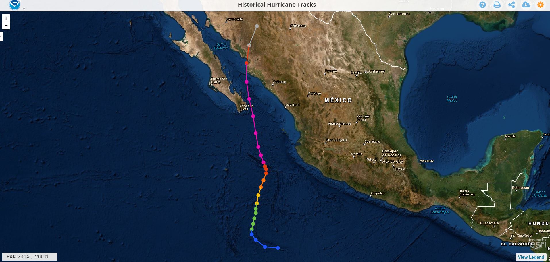
This hurricane reached category 4 on September 30, 1976 before hitting the southern peninsula of Baja California and Sonora with force, it hit the bay of La Paz leaving in its wake a great devastation, and -to date more than 43 years after the event- there is no official death toll; The virtual sources that recall the cyclone indicate that the Ángel César Alvarado government initially spoke of 600 people being killed, however, since then it has been speculated that the victims could be between 2,000 and up to 5,000 . The natural phenomenon left 10,000 victims, with total damages of 3 million pesos .

Of course: all the sources consulted coincide in pointing to this cyclone as " The worst disaster in the history of Baja California Su r"
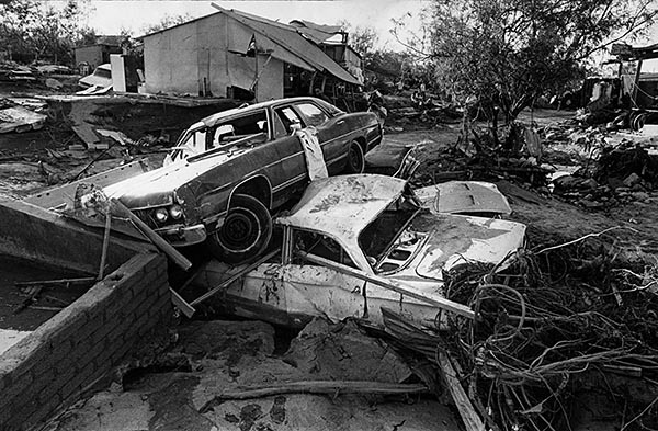
Oct. 2, 1976: Car rests on top of second in aftermath of Hurrican Liza that lashed La Paz, Mexico. Over 400 people were died in La Paz. This photo was published in the Oct. 3, 1976 Los Angeles Times.

Real evidence of Mrs. Irma

What Doña Irma remembers the most is the next day: October 1, when with her husband and son they went home to the Infonavit neighborhood .

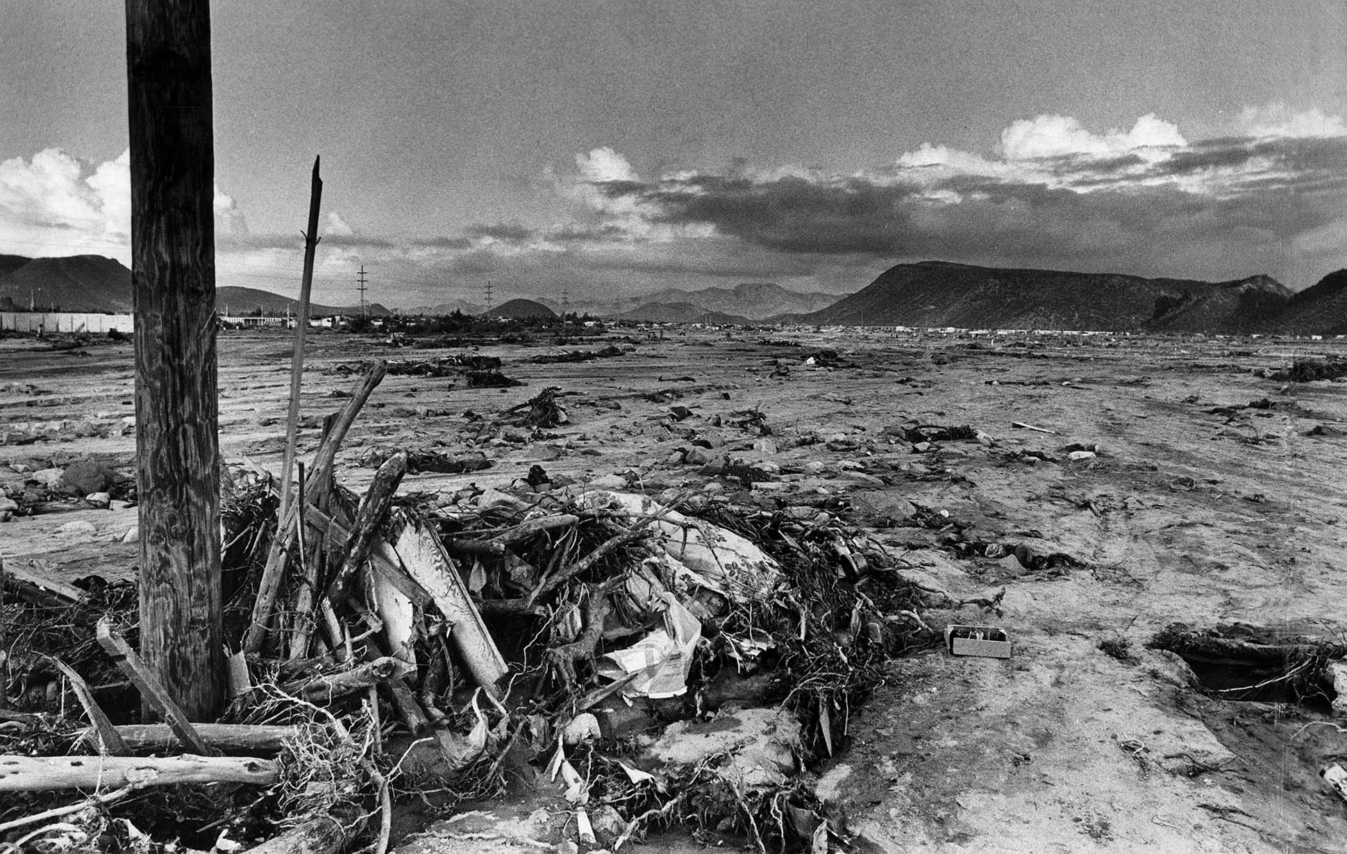
"It looked like La Paz had been bombed," he said. In the course of his parents' house to his home, crossing as best they could by the Forjadores, he assures that from Morelos High School to Colima he saw approximately 30 or more citizens dead, semi-buried and full of mud , who had literally been thrown onto the streets by the streams. Many more did not have the same "luck", as the current took them directly to the sea, without their whereabouts ever being known.

Hurricane Janet 1955

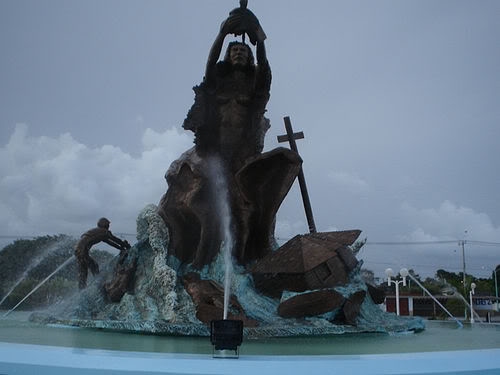
Renaissance Monument after Hurricane Janet (1955)

It is the first of which there is a record. The Hurricane Janet cataloged as category 5 on the Saffir-Simpson scale, made landfall on September 27, 1955, in Quintana Roo. According to the press of the time, the most affected city was precisely its capital, Chetumal, leaving 712 dead in its wake (data from Cenapred ) and devastated practically all the houses that were found since most of them were made in such a way.

Unusual cases:
Each hurricane has its own way of leaving its mark and leaving something in particular that the population does not forget, in the case of Hurricane Janet, how to forget the flag that crossed a tree, from which there is a replica on the esplanade of the flag (main park of Chetumal). Another unusual case is that of the “flying house” and the concrete pond that was wound on a palm tree. The "flying house" exists is made of wood and zinc sheet, it is on the Veracruz road with 22 de Enero corner in the center of the city. The anecdote, " was dragged more than 500 meters from its initial location, with about 25 people inside, during the impact of Janet" .

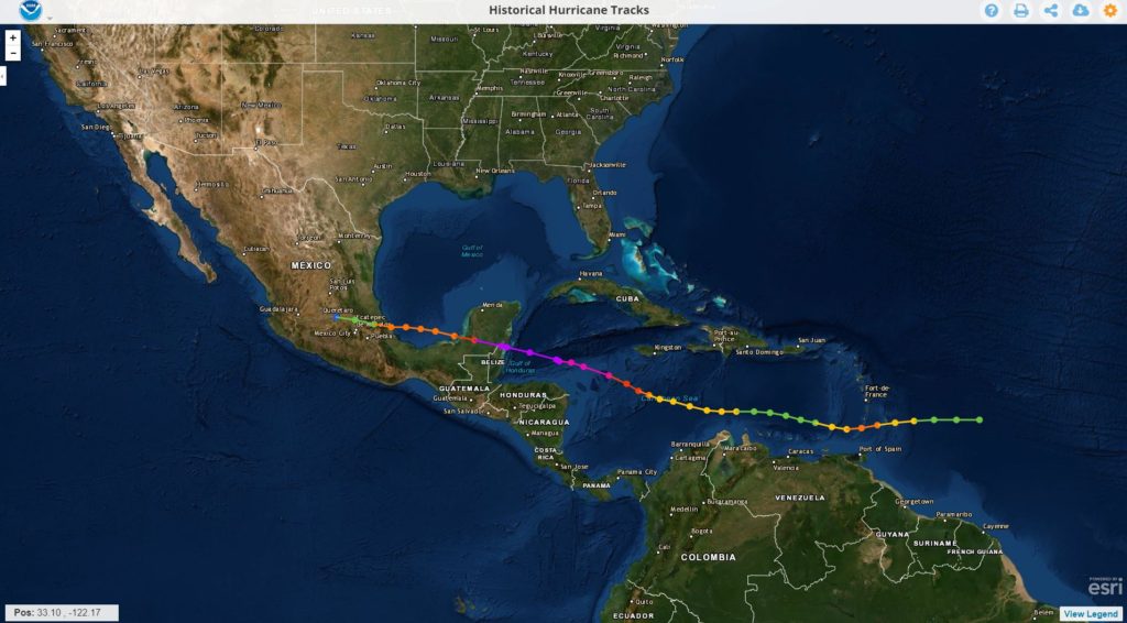
This was the path Janet took

As it happens in our days, many people left the protection of their family and their homes until the end . Expensive they would pay big mistake. In addition, just a few days earlier, on September 19, another hurricane had visited south of Quintana Roo "Hilda" that had basically passed through the area of ​​Felipe Carrillo Puerto, causing very slight damage in Chetumal. Then it was naively thought that this had already covered the "annual quota" of hurricanes, today we know that this does not work that way, even the worst was lacking ...

Hurricanes, earthquakes, and other natural disasters

Hurricanes, earthquakes, and other natural disasters obey the same mathematical patterns.

Si se toma nota de la magnitud de varios fenómenos naturales catastróficos y se dibuja en un gráfico cuantos episodios han tenido lugar de cada uno de ellos a lo largo de la historia, el resultado no es impredecible. Muy al contrario sigue una curva muy bien definida en la que, por suerte, cuanto mayor es su capacidad de devastación, menor es la frecuencia con que se convierten. Por ejemplo, muy pocos terremotos llegan a ser catastróficos, mientras  que continuamente tienen lugar numerosos terremotos pequeños o bien sismos que la mayoría de ellos son tan débiles que pasan desapercibidos para las personas y solo pueden ser detectados por instrumentos muy sensibles. Pero esta información es fundamental para poder calcular los riesgos asociados. Sin embargo, esta dependencia no siempre suele ser la misma ni se ajusta a la misma función matemática, en particular con respecto a los eventos mas grandes. Álvaro Corral y Álvaro González, investigadores del Centro de Investigación Matemática (CRM) y el Departamento de Matemáticas de la UAB, han realizado un análisis estadistico preciso de todo un conjunto de fenómenos naturales que pueden provocar desastres: Terremotos, Huracanes, Incendios forestales, Impactos de meteoritos en la atmósfera, lluvias torrenciales y hundimientos del suelo. Tras analizar los datos de miles de episodios de diferente intensidad de cada uno de estos fenómenos, estos investigadores han conseguido describir con una misma técnica matemática las funciones que relacionan la frecuencia de estos fenómenos con el valor de su magnitud o tamaño. La mayoría de ellos siguen la llamada ley de potencia, según la cual los eventos son cada vez más abundantes cuanto más pequeños son, sin que tengan un tamaño “normal” o típico

Disappearance of El Niño, with it will come strong cyclonic activity: specialist

The peak of the hurricane season begins in late August

The current season has behaved weakly, but it is not necessary to let your guard down , since the phenomenon of El Niño is close to disappearing and with this it will begin to take more forces cyclonic activity in the Atlantic Ocean.

The meteorologist of the Institutional Committee for the Attention of Extreme Meteorological Phenomena of the UADY, Juan Vázquez Montalvo, pointed out that, so far, the hurricane season has developed very weakly, presenting only one event in advance, in May, with the formation of the Hurricane Andrea and Barry, this month.

Danger

Vázquez Montalvo recalled that it is precisely in September when the Yucatan Peninsula has been vulnerable to major cyclones such as Gilberto and Isidoro, which hit the State in September.

“Since we no longer have the El Niño phenomenon, we will be in neutral conditions with tendencies for La Niña to form. During this period, the trend is to have explosive cyclone growth, which has not happened until now, "he insisted.

In this sense, he explained that El Niño with its cutting winds does not allow cyclones to form and there is an erratic behavior as it happened with Barry, which did not allow it to develop.

source: sipse.com

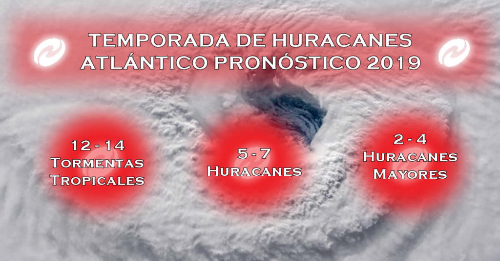
HURRICANE SEASON BEGINS 2019 How many hurricanes are expected?

The hurricane season began today in the Pacific and in the Atlantic it will begin in June, both will end in late November of this 2019. The names of the hurricanes are recycled every six years.

For this hurricane season in the Atlantic this is the forecast.

Asimismo, se pronosticó Centro Nacional de Huracanes (NHC, por sus siglas en inglés) que en el Océano Pacífico habrán 24 huracanes, mientras que para el Atlántico prevé 21.


source: Sipse.com

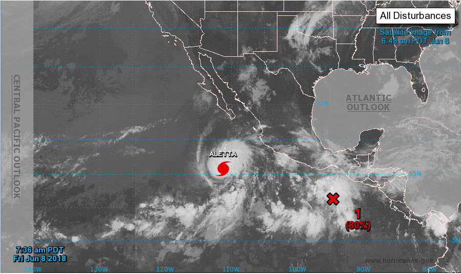
Huracán ALETTA Categoría 4

Perspectiva del clima tropical
NWS National Hurricane Center Miami FL
500 a.m. PDT vie 08 de junio 2018

Para el este del Pacífico Norte ... al este de 140 grados de longitud oeste:

El Centro Nacional de Huracanes está emitiendo avisos sobre huracanes
Aletta ubicada a varios cientos de millas al oeste-suroeste de Manzanillo
Méjico.

Actividad de lluvia y tormenta asociada con un área amplia de baja
presión ubicada a unos cientos de millas al sur del Golfo de
Tehuantepec ha aumentado durante las últimas horas, pero permanece
desestructurado. Se pronostica que los vientos de nivel superior serán propicios
para el desarrollo más tarde hoy, y una depresión tropical o tropical
se espera que la tormenta se forme durante el fin de semana mientras el sistema se mueve
hacia el oeste al oeste-noroeste de la costa del sur de México.
* Posibilidad de formación durante 48 horas ... alto ... 80 por ciento.
* Posibilidad de formación a través de 5 días ... alto ... 90 por ciento.

Fuente: NOAA