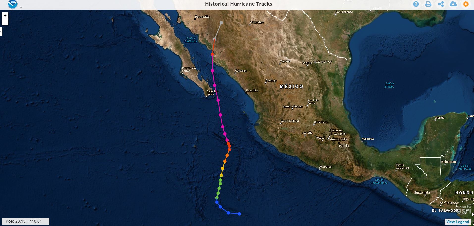
Hurricane Liza 1976
This hurricane reached category 4 on September 30, 1976 before hitting the southern peninsula of Baja California and Sonora with force, it hit the bay of La Paz leaving in its wake a great devastation, and -to date more than 43 years after the event- there is no official death toll; The virtual sources that recall the cyclone indicate that the Ángel César Alvarado government initially spoke of 600 people being killed, however, since then it has been speculated that the victims could be between 2,000 and up to 5,000 . The natural phenomenon left 10,000 victims, with total damages of 3 million pesos .
Of course: all the sources consulted coincide in pointing to this cyclone as " The worst disaster in the history of Baja California Su r"
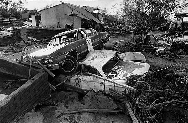
Real evidence of Mrs. Irma
What Doña Irma remembers the most is the next day: October 1, when with her husband and son they went home to the Infonavit neighborhood .
"It looked like La Paz had been bombed," he said. In the course of his parents' house to his home, crossing as best they could by the Forjadores, he assures that from Morelos High School to Colima he saw approximately 30 or more citizens dead, semi-buried and full of mud , who had literally been thrown onto the streets by the streams. Many more did not have the same "luck", as the current took them directly to the sea, without their whereabouts ever being known.
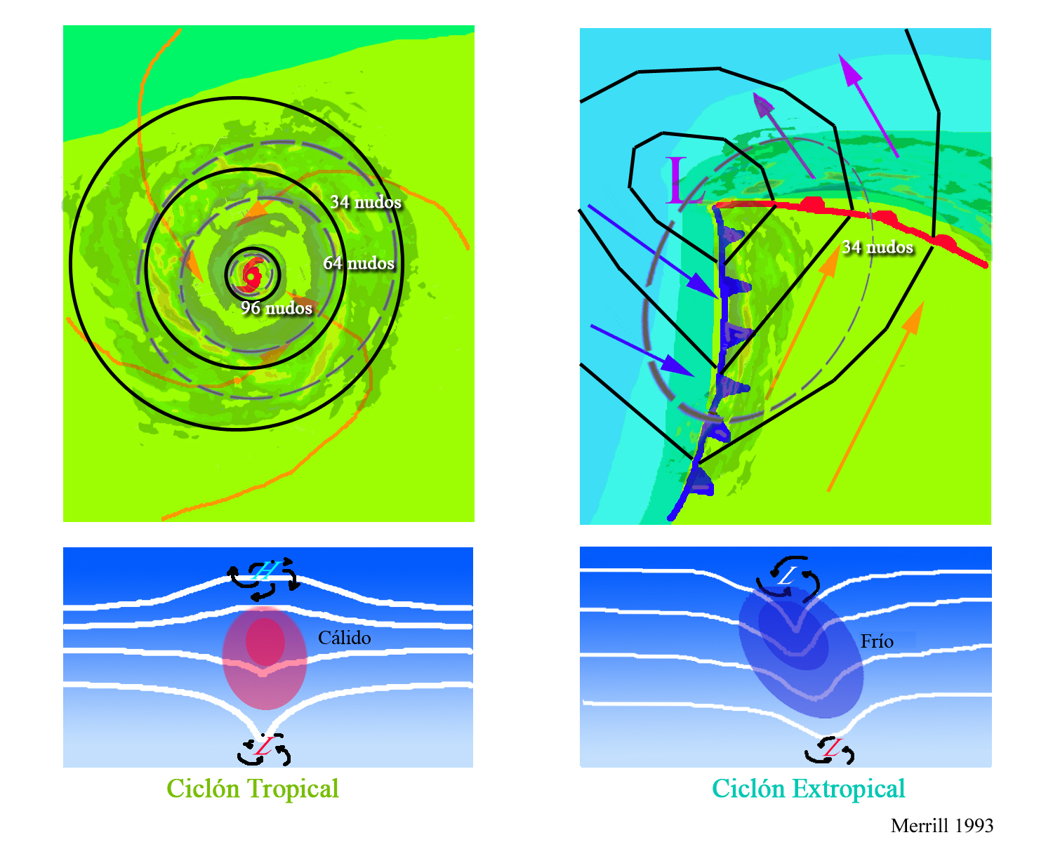 The upper diagrams show horizontal maps of surface temperature, pressure, and wind fields associated with a tropical cyclone (left) and an extratropical cyclone (right) . Colors indicate temperature (blue 15 ° C = 59 ° F, green blue 20 ° C = 68 ° F, green 25 ° C = 77 ° F). Dashed lines indicate surface wind speeds: 34 kt = 39 mph = 63 kph, 64 kt = 74 mph = 117 kph, and 96 kt = 110 mph = 174 kph. Continuous lines are the isobars.